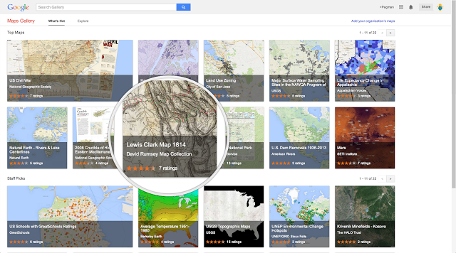
กูเกิลเปิดตัวบริการใหม่ Google Maps Gallery โดยกูเกิลจะนำภาพแผนที่ในอดีต (ที่วาดด้วยมือ) หรือแผนที่/ข้อมูลเชิงสถิติจากหน่วยงานต่างๆ มา "ทาบ" ลงบน Google Maps ให้ดูกันง่ายๆ
ตัวอย่างแผนที่ใน Google Maps Gallery ได้แก่
- แผนที่การเดินทัพในสงครามกลางเมืองของสหรัฐ
- แผนที่แสดงอัตราการเข้าถึงอินเทอร์เน็ตของคนในประเทศต่างๆ (ข้อมูลจากธนาคารโลก)
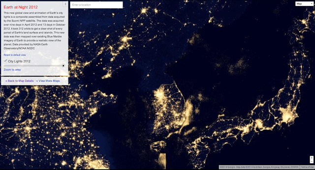
- แผนที่โลกตอนกลางคืน เห็นแสงไฟของเมืองต่างๆ (ภาพจาก NASA) จะเห็นว่าเกาหลีเหนือแทบไม่มีแสงไฟเลย
กูเกิลขอข้อมูลและแผนที่จากหน่วยงานหลายแห่งมาแสดงใน Maps Gallery เช่น National Geographic Society, World Bank Group, United States Geological Survey ใครสนใจก็ตามไปเล่นกันได้ที่ลิงก์ด้านบนครับ
ที่มา - Google Lat Long


Get latest news from Blognone
Follow @twitterapi


Comments
นี่มันสื่อการสอนวิชาประวัติศาสตร์ชัดๆ
แผนที่ปราสาทพระวิหารมีมะ :p