
Page Summary
-
The NASA VIIRS Thermal Anomalies/Fire (VNP14A1) dataset provides daily information on active fires and thermal anomalies globally at 1km resolution.
-
The dataset is available from 2012-01-19 to 2025-10-15 with a daily update cadence.
-
Bands in the dataset include FireMask for confidence, MaxFRP for fire radiative power, QA for quality control, and sample number.
-
Data is freely accessible from NASA LP DAAC, with a request to cite when used in publications.
-
The dataset can be explored and analyzed using the Google Earth Engine platform.
- Dataset Availability
- 2012-01-19T00:00:00Z–2026-06-09T00:00:00Z
- Dataset Producer
- NASA LP DAAC at the USGS EROS Center
- Cadence
- 1 Day
- Tags
Description
The daily Suomi National Polar-Orbiting Partnership NASA Visible Infrared Imaging Radiometer Suite (VIIRS) Thermal Anomalies/Fire (VNP14A1) Version 1 data product provides daily information about active fires and other thermal anomalies. The VNP14A1 data product is a global, 1km gridded composite of fire pixels detected from VIIRS 750m bands over a daily (24-hour) period. The VNP14 data products are designed after the Moderate Resolution Imaging Spectroradiometer (MODIS) Thermal Anomalies/Fire product suite.
Documentation:
Bands
Bands
Pixel size: 1000 meters (all bands)
FireMask
Confidence of fire.
MaxFRP
Maximum Fire Radiative Power
QA
Global Land Surface Phenology Quality Control
sample
Sample number within a swath
FireMask Class Table
| Value | Color | Description |
|---|---|---|
|
0
|
None | Not processed (no data or poor quality data) |
|
1
|
None | Not processed (bowtie deletion) |
|
2
|
None | Unused |
|
3
|
None | Water |
|
4
|
None | Cloud |
|
5
|
None | Land |
|
6
|
None | Unclassified |
|
7
|
None | Low confidence fire pixel |
|
8
|
None | Nominal confidence fire pixel |
|
9
|
None | High confidence fire pixel |
Terms of Use
Terms of Use
LP DAAC NASA data are freely accessible; however, when an author publishes these data or works based on the data, it is requested that the author cite the datasets within the text of the publication and include a reference to them in the reference list.
Citations
-
Please visit LP DAAC 'Citing Our Data' page for information on citing LP DAAC datasets.
DOIs
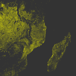
Explore with Earth Engine
Code Editor (JavaScript)
 var

 dataset

 =

 ee
 .
 ImageCollection
 (
 'NASA/VIIRS/002/VNP14A1'
 )

 .
 filter
 (
 ee
 .
 Filter
 .
 date
 (
 '2017-05-01'
 ,

 '2017-12-30'
 ));
 var

 visualization

 =

 {

 bands
 :
 [
 'MaxFRP'
 ],

 min
 :

 0.0
 ,

 max
 :

 1.0
 ,

 palette
 :

 [
 '#00FF00'
 ,

 '#00FFFF'
 ,

 '#00FF00'
 ,

 '#FFFFE0'
 ,

 '#FFFFA0'
 ,

 '#FFFF00'
 ],
 };
 var

 lon

 =

 38.06
 ;
 var

 lat

 =

 -
 14.22
 ;
 Map
 .
 setCenter
 (
 lon
 ,

 lat
 ,

 6
 );
 Map
 .
 addLayer
 (
 dataset
 ,

 visualization
 ,

 'MaxFRP'
 );