
Page Summary
-
The United Nations Geodata is a worldwide geospatial dataset provided by United Nations Geospatial.
-
This dataset is intended to facilitate the preparation of cartographic materials within the United Nations by providing geometry, attributes, and labels for geographic features.
-
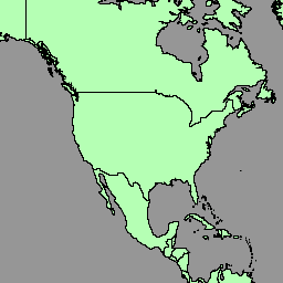
The BNDA_simplified dataset includes polygons/areas of countries.
-
The UN Geodata can be used by UN Secretariat and external users but commercial use is prohibited, and the UN must be credited as the data source.
-
Earth Engine is a platform for analyzing and visualizing geospatial datasets and is free for research, education, and nonprofit use.
- Dataset Availability
- 2023-02-11T00:00:00Z–2023-02-12T00:00:00Z
- Dataset Producer
- United Nations Geospatial
- Tags
Description
The United Nations Geospatial Data, or Geodata, is a worldwide geospatial dataset of the United Nations.
The United Nations Geodata is provided to facilitate the preparation of cartographic materials in the United Nations includes geometry, attributes and labels to facilitate the adequate depiction and naming of geographic features for the preparation of maps in accordance with United Nations policies and practices.
The geospatial dataset include polygons/areas of countries (BNDA_simplified). Please refer this page for more information.
Table Schema
Table Schema
ISO-3166 alpha-3 code of the area's administrator.
UN M49 geographical region code
UN M49 geographic region
GlobalID
GlobalID_1
UN M49 intermediary region code; 0 if unset
UN M49 intermediary region; empty if "int_cd" is 0
ISO-3166 alpha-2 code
ISO-3166 alpha-3 code
Cartographic label (English)
Cartographic label (French)
UN M49 country or area code
Name (English)
Name (French)
Internal object ID number
Total area of the geometry
Sovereignty status code:
- 0: Antarctica
- 1: State
- 2: Occupied Palestinian Territory
- 3: Non-Self Governing Territory
- 4: Territory
- 5: Special Region or Province
- 99: Undetermined
UN M49 sub-region code
UN M49 sub-region
Terms of Use
Terms of Use
The UN Geodata is a global geospatial database available for use by the UN Secretariat and external users. It can be used for various purposes, but commercial use is prohibited. The UN retains ownership of the data, and users must credit the UN as the source in their creations. The data is provided "as is" without warranties, and the UN is not liable for any damages or losses arising from its use. Please refer this page for more information.
Explore with Earth Engine
Code Editor (JavaScript)
 var

 dataset

 =

 ee
 .
 FeatureCollection
 (
 'UN/Geodata/BNDA_simplified/current'
 );
 var

 styleParams

 =

 {

 fillColor
 :

 'b5ffb4'
 ,

 color
 :

 '00909F'
 ,

 width
 :

 1.0
 ,
 };
 dataset

 =

 dataset
 .
 style
 (
 styleParams
 );
 Map
 .
 centerObject
 (
 dataset
 );
 Map
 .
 addLayer
 (
 dataset
 ,

 {},

 'BNDA simplified'
 );