
Description
The Overture Maps Places theme contains more than 64 million point representations of real-world entities: businesses, schools, hospitals, religious organizations, landmarks, mountain peaks, and much more.
Each place record includes location coordinates, names, categories, contact information (websites, social media, emails, phones), brand information, addresses, and operating status. A confidence score indicates the certainty of each place's existence.
This dataset is part of the Overture Maps Foundation's collaborative effort to develop interoperable open map data. The data is released monthly and always reflects the most recent release.
Data source: Overture Maps Foundation
Documentation: Places Theme Guide
BigQuery table: bigquery-public-data.overture_maps.place
BigQuery Table Schema
Table Schema
| Name | Type | Description |
|---|---|---|
|
addresses
|
RECORD_LIST | The addresses of the place. Array of address records, each containing: freeform (street address text), locality (city/town name), postcode, region (administrative region code, e.g., "US-NY"), and country (ISO country code, e.g., "US"). |
|
bbox
|
RECORD | Bounding box of the feature geometry. Record with fields: xmin (minimum longitude), xmax (maximum longitude), ymin (minimum latitude), ymax (maximum latitude). |
|
brand
|
RECORD | The brand of the place. Record containing: names (brand name container with primary and common names) and wikidata (Wikidata identifier for the brand). Places with multiple brands are represented as separate place entries. |
|
categories
|
RECORD | The categories of the place. Record containing: primary (the main category of the place) and alternate (array of additional applicable categories). Complete list available on GitHub . |
|
confidence
|
DOUBLE | The confidence of the existence of the place. A number between 0 and 1, where higher values indicate greater certainty. |
|
emails
|
RECORD_LIST | The email addresses associated with the place. Array of records containing email address strings. |
|
geometry
|
GEOMETRY | Point geometry in WGS84 (EPSG:4326). |
|
id
|
STRING | A feature ID. This may be an ID associated with the Global Entity Reference System (GERS). |
|
names
|
RECORD | The names of the place. Record containing: primary (main name), common (translations by language code, e.g., "es" for Spanish), and rules (array of naming variants such as short forms or abbreviations). |
|
operating_status
|
STRING | Indicates operating status of a place. Possible values: 'open', 'permanently_closed', or 'temporarily_closed'. |
|
phones
|
RECORD_LIST | The phone numbers associated with the place. Array of records containing phone number strings. |
|
socials
|
RECORD_LIST | The social media profiles of the place. Array of records containing URLs to social media pages. |
|
sources
|
RECORD_LIST | Source attribution for the feature properties. Array of records, each containing: property (property name in JSON Pointer notation), dataset (source dataset name), and record_id (identifier in the source dataset). |
|
version
|
INT | Version number of the feature, incremented in each Overture release where geometry or attributes changed. |
|
websites
|
RECORD_LIST | The websites associated with the place. Array of records containing URLs to the place's websites. |
Terms of Use
Terms of Use
Explore with Earth Engine
Code Editor (JavaScript)
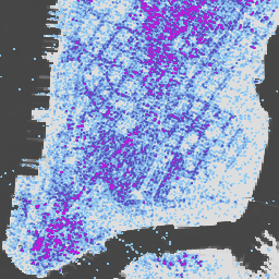
 // Load the Overture Maps Places collection using the BigQuery connector.
 var

 places

 =

 ee
 .
 FeatureCollection
 .
 loadBigQueryTable
 (

 'bigquery-public-data.overture_maps.place'
 );
 // Center the map on New York City.
 Map
 .
 setCenter
 (
 -
 74.006
 ,

 40.7128
 ,

 12
 );
 // Filter to show places in a specific area (Manhattan).
 var

 manhattan

 =

 ee
 .
 Geometry
 .
 Rectangle
 ([
 -
 74.02
 ,

 40.7
 ,

 -
 73.97
 ,

 40.78
 ]);
 var

 manhattanPlaces

 =

 places
 .
 filterBounds
 (
 manhattan
 );
 // Add the places layer to the map.
 Map
 .
 addLayer
 (
 manhattanPlaces
 ,

 {
 color
 :

 '4285f4'
 },

 'Overture Places'
 );