-
CFSR: Climate Forecast System Reanalysis
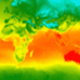
The National Centers for Environmental Prediction (NCEP) Climate Forecast System Reanalysis (CFSR) was designed and executed as a global, high-resolution, coupled atmosphere-ocean-land surface-sea ice system to provide the best estimate of the state of these coupled domains over the 32-year period of record from January … climate daylight flux forecast geophysical ncep -
CFSV2: NCEP Climate Forecast System Version 2, 6-Hourly Products
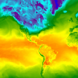
The National Centers for Environmental Prediction (NCEP) Climate Forecast System (CFS) is a fully coupled model representing the interaction between the Earth's atmosphere, oceans, land, and sea ice. CFS was developed at the Environmental Modeling Center (EMC) at NCEP. The operational CFS was upgraded to … climate daylight flux forecast geophysical ncep -
RTMA: Real-Time Mesoscale Analysis
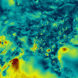
The Real-Time Mesoscale Analysis (RTMA) is a high-spatial and temporal resolution analysis for near-surface weather conditions. This dataset includes hourly analyses at 2.5 km for CONUS. atmosphere climate cloud geophysical humidity noaa

Skip to main content
Datasets tagged nws in Earth Engine
[[["Easy to understand","easyToUnderstand","thumb-up"],["Solved my problem","solvedMyProblem","thumb-up"],["Other","otherUp","thumb-up"]],[["Missing the information I need","missingTheInformationINeed","thumb-down"],["Too complicated / too many steps","tooComplicatedTooManySteps","thumb-down"],["Out of date","outOfDate","thumb-down"],["Samples / code issue","samplesCodeIssue","thumb-down"],["Other","otherDown","thumb-down"]],[],[[["\u003cp\u003eThe National Centers for Environmental Prediction (NCEP) provides various climate and weather datasets, including reanalysis, forecast, and real-time analysis data.\u003c/p\u003e\n"],["\u003cp\u003eCFSR offers a 32-year record of global, high-resolution, coupled atmosphere-ocean-land surface-sea ice system data.\u003c/p\u003e\n"],["\u003cp\u003eCFSV2 is an upgraded, fully coupled model representing the interaction between the Earth's atmosphere, oceans, land, and sea ice.\u003c/p\u003e\n"],["\u003cp\u003eRTMA delivers hourly, high-resolution analyses of near-surface weather conditions for the contiguous United States.\u003c/p\u003e\n"]]],[],null,["# Datasets tagged nws in Earth Engine\n\n-\n\n |---------------------------------------------------------------------------------------------------------------------------------------------------------------------------------------------------------------------------------------------------------------------------------------------------------------------------------------|\n | [### CFSR: Climate Forecast System Reanalysis](/earth-engine/datasets/catalog/NOAA_CFSR) |\n | The National Centers for Environmental Prediction (NCEP) Climate Forecast System Reanalysis (CFSR) was designed and executed as a global, high-resolution, coupled atmosphere-ocean-land surface-sea ice system to provide the best estimate of the state of these coupled domains over the 32-year period of record from January ... |\n | [climate](/earth-engine/datasets/tags/climate) [daylight](/earth-engine/datasets/tags/daylight) [flux](/earth-engine/datasets/tags/flux) [forecast](/earth-engine/datasets/tags/forecast) [geophysical](/earth-engine/datasets/tags/geophysical) [ncep](/earth-engine/datasets/tags/ncep) |\n\n-\n\n |-----------------------------------------------------------------------------------------------------------------------------------------------------------------------------------------------------------------------------------------------------------------------------------------------------------------------|\n | [### CFSV2: NCEP Climate Forecast System Version 2, 6-Hourly Products](/earth-engine/datasets/catalog/NOAA_CFSV2_FOR6H) |\n | The National Centers for Environmental Prediction (NCEP) Climate Forecast System (CFS) is a fully coupled model representing the interaction between the Earth's atmosphere, oceans, land, and sea ice. CFS was developed at the Environmental Modeling Center (EMC) at NCEP. The operational CFS was upgraded to ... |\n | [climate](/earth-engine/datasets/tags/climate) [daylight](/earth-engine/datasets/tags/daylight) [flux](/earth-engine/datasets/tags/flux) [forecast](/earth-engine/datasets/tags/forecast) [geophysical](/earth-engine/datasets/tags/geophysical) [ncep](/earth-engine/datasets/tags/ncep) |\n\n-\n\n |-------------------------------------------------------------------------------------------------------------------------------------------------------------------------------------------------------------------------------------------------------------------------------------------------|\n | [### RTMA: Real-Time Mesoscale Analysis](/earth-engine/datasets/catalog/NOAA_NWS_RTMA) |\n | The Real-Time Mesoscale Analysis (RTMA) is a high-spatial and temporal resolution analysis for near-surface weather conditions. This dataset includes hourly analyses at 2.5 km for CONUS. |\n | [atmosphere](/earth-engine/datasets/tags/atmosphere) [climate](/earth-engine/datasets/tags/climate) [cloud](/earth-engine/datasets/tags/cloud) [geophysical](/earth-engine/datasets/tags/geophysical) [humidity](/earth-engine/datasets/tags/humidity) [noaa](/earth-engine/datasets/tags/noaa) |"]]