Engineering Technology - Geomatics

Engineering Technology - Geomatics - AAS
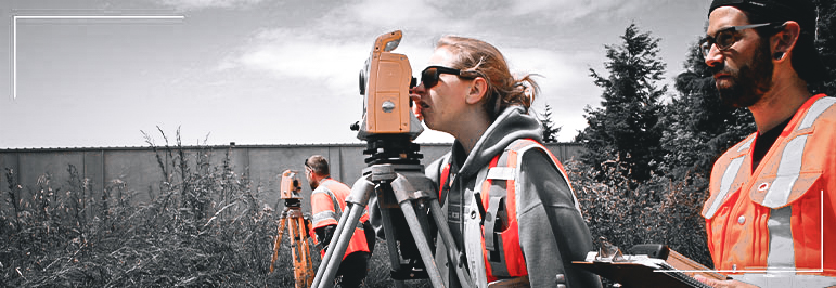
If you’d like to prepare for a career in a growing field that won’t confine you to an office, then check out the Geomatic Engineering Technology associate degree program at Bellingham Technical College. You can put your math and computer skills to work as a surveying and mapping technician or land surveyor in a construction firm; a surveying and engineering firm; a mining, oil or gas company; a public utility; or a government agency, such as U.S. Geological Survey, Department of Natural Resources, the Bureau of Land Management, or the U.S. Forestry Service.
BTC’s associate degree in Geomatics includes training in GIS, AutoCAD and GPS skills, as well as gain a working knowledge of Washington laws and standards related to surveying, boundaries and map preparation.
Employment Information
Data are provided on a program (not credential) level
79% 1
BTC graduate placement rate (Employment Security Department- WA and OR only)
96% 3
BTC graduate placement rate (faculty-tracked, national)
96% 3
BTC in-field graduate placement rate (faculty-tracked, national)
Entry Information
When Can I Start?
Students may begin working toward this degree quarterly.
What are the Minimum Entry Requirements?
Admissions application and assessment testing in Reading, Math and Writing is required. Your score on the test and/or your previous transcripts will determine where you begin your course sequence. Contact Admissions at 360.752.8345 or at admissions@btc.edu for assistance with academic planning.
What are My Next Steps?
Classes
Program Outcomes
- Graduates will demonstrate competency in basic GIS and surveying and mapping skills;
- Graduates will prepare for the Level I Survey Technical Exam given by the Career Development Committee of LSAW;
- Graduates will possess the ability to prepare a topographic map of a parcel of property that is evaluated by WAC 332-130 standards;
- Graduates will demonstrate entry level competency in using CAD skills;
- Graduates will demonstrate a working knowledge of the Global Positioning System (GPS) as well as demonstrate a working knowledge of Washington Law related to surveying and boundaries;
- Graduates will receive, interpret, and convey written, verbal, and graphic information.
Employment Outlook
The average annual wage in this field is $64,970, with an earning potential of about $77,808 per year.*
Criminal convictions may restrict or prevent student participation with internships and employment in this industry.
Most program graduates work as surveying and mapping technicians and are employed in direct field service. Opportunities exist in construction companies, private surveying and engineering firms, mining, oil, and gas extraction companies, public utilities, and city, county, state, and federal government agencies (i.e., U.S. Forestry Department, Department of Natural Resources, Department of Interior, U.S. Geological Survey, and Bureau of Land Management).
Faculty & Support

Colin Hopps
GeomaticsContacts
If you have questions about this program or want help with the admissions steps to Bellingham Technical College, please email outreach@btc.edu .
Current students wanting academic planning and support, can connect with the program Instructor(s) or email EngineeringNav@btc.edu


