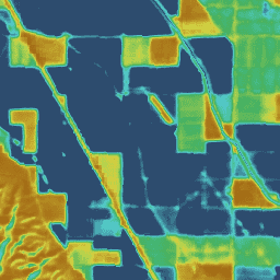
Operational Simplified Surface Energy Balance (SSEBop)
The Operational Simplified Surface Energy Balance (SSEBop) model by Senay
et al. (2013, 2017) is a thermal-based simplified surface energy model for
estimating actual ET based on the principles of satellite psychrometry
(Senay 2018). The OpenET SSEBop implementation uses land surface temperature
(Ts) from Landsat (Collection 2 Level-2 Science Products) with key model
parameters (cold/wet-bulb reference, Tc, and surface psychrometric
constant, 1/dT) derived from a combination of observed surface temperature,
normalized difference vegetation index (NDVI), climatological average
(1980-2017) daily maximum air temperature (Ta, 1-km) from Daymet, and
net radiation data from ERA-5. This model implementation uses the Google
Earth Engine processing framework for connecting key SSEBop ET functions
and algorithms together when generating both intermediate and aggregated ET
results. A detailed study and evaluation of the SSEBop model across CONUS
(Senay et al., 2022) informs both cloud implementation and assessment for
water balance applications at broad scales. Notable model (v0.2.6)
enhancements and performance against previous versions include additional
compatibility with Landsat 9 (launched Sep 2021), global model
extensibility, and improved parameterization of SSEBop using
FANO (Forcing and Normalizing Operation) to better estimate ET
in all landscapes and all seasons regardless of vegetation cover density,
thereby improving model accuracy by avoiding extrapolation of Tc to
non-calibration regions.
Senay, G.B., Parrish, G.E., Schauer, M., Friedrichs, M., Khand, K., Boiko,
O., Kagone, S., Dittmeier, R., Arab, S. and Ji, L., 2023. Improving the
Operational Simplified Surface Energy Balance Evapotranspiration Model Using
the Forcing and Normalizing Operation. Remote Sensing, 15(1), p.260.doi:10.3390/rs15010260
Senay, G.B., Bohms, S., Singh, R.K., Gowda, P.H., Velpuri, N.M., Alemu,
H. and Verdin, J.P., 2013. Operational evapotranspiration mapping using
remote sensing and weather datasets: A new parameterization for the SSEB
approach. JAWRA Journal of the American Water Resources Association,
49(3), pp.577-591.doi:10.1111/jawr.12057
Senay, G.B., Schauer, M., Friedrichs, M., Velpuri, N.M. and Singh, R.K.,
2017. Satellite-based water use dynamics using historical Landsat data
(1984–2014) in the southwestern United States. Remote Sensing of
Environment, 202, pp.98-112.doi:10.1016/j.rse.2017.05.005c
Senay, G.B., 2018. Satellite psychrometric formulation of the
Operational Simplified Surface Energy Balance (SSEBop) model for
quantifying and mapping evapotranspiration. Applied Engineering in
Agriculture, 34(3), pp.555-566.doi:10.13031/aea.12614
Senay, G.B., Friedrichs, M., Morton, C., Parrish, G.E., Schauer, M.,
Khand, K., Kagone, S., Boiko, O. and Huntington, J., 2022. Mapping
actual evapotranspiration using Landsat for the conterminous United
States: Google Earth Engine implementation and assessment of the SSEBop
model. Remote Sensing of Environment, 275, p.113011.doi:10.1016/j.rse.2022.113011
Operational Simplified Surface Energy Balance (SSEBop) The Operational Simplified Surface Energy Balance (SSEBop) model by Senay et al. (2013, 2017) is a thermal-based simplified surface energy model for estimating actual ET based on the principles of satellite psychrometry (Senay 2018). The OpenET SSEBop implementation uses land surface temperature (Ts) from …
[[["Easy to understand","easyToUnderstand","thumb-up"],["Solved my problem","solvedMyProblem","thumb-up"],["Other","otherUp","thumb-up"]],[["Missing the information I need","missingTheInformationINeed","thumb-down"],["Too complicated / too many steps","tooComplicatedTooManySteps","thumb-down"],["Out of date","outOfDate","thumb-down"],["Samples / code issue","samplesCodeIssue","thumb-down"],["Other","otherDown","thumb-down"]],[],[[["\u003cp\u003eThe OpenET SSEBop dataset provides monthly evapotranspiration (ET) estimates for the contiguous United States (CONUS) from 2008 to 2023.\u003c/p\u003e\n"],["\u003cp\u003eIt leverages the Operational Simplified Surface Energy Balance (SSEBop) model, utilizing Landsat and GRIDMET data for calculations.\u003c/p\u003e\n"],["\u003cp\u003eThe dataset offers 30-meter resolution imagery with bands representing ET values and the number of cloud-free observations used in the estimation.\u003c/p\u003e\n"],["\u003cp\u003eData is freely available under the CC-BY-4.0 license and is accessible through the Google Earth Engine platform.\u003c/p\u003e\n"],["\u003cp\u003eOpenET SSEBop is extensively documented with publications detailing its methodology, validation, and applications in water balance studies.\u003c/p\u003e\n"]]],["The dataset provides monthly evapotranspiration (ET) estimates from the Operational Simplified Surface Energy Balance (SSEBop) model, covering 1999-10-01 to 2023-12-01. The model, implemented by OpenET, uses Landsat surface temperature data and other sources to derive actual ET. Key improvements include Landsat 9 compatibility, global model extension, and enhanced parameterization for better ET estimation across landscapes. Users can access the data via Google Earth Engine, with a 30-meter pixel size. Data, provided by [OpenET, Inc.](https://openetdata.org/), is under CC-BY-4.0.\n"],null,["Dataset Availability\n: 1999-10-01T00:00:00Z--2024-12-01T00:00:00Z\n\nDataset Provider\n:\n\n\n [OpenET, Inc.](https://openetdata.org/)\n\nCadence\n: 1 Month\n\nTags\n:\n[evapotranspiration](/earth-engine/datasets/tags/evapotranspiration) [gridmet-derived](/earth-engine/datasets/tags/gridmet-derived) [landsat-derived](/earth-engine/datasets/tags/landsat-derived) [monthly](/earth-engine/datasets/tags/monthly) [openet](/earth-engine/datasets/tags/openet) [water](/earth-engine/datasets/tags/water) [water-vapor](/earth-engine/datasets/tags/water-vapor) \n\nDescription \nOperational Simplified Surface Energy Balance (SSEBop)\n\nThe Operational Simplified Surface Energy Balance (SSEBop) model by Senay\net al. (2013, 2017) is a thermal-based simplified surface energy model for\nestimating actual ET based on the principles of satellite psychrometry\n(Senay 2018). The OpenET SSEBop implementation uses land surface temperature\n(Ts) from Landsat (Collection 2 Level-2 Science Products) with key model\nparameters (cold/wet-bulb reference, Tc, and surface psychrometric\nconstant, 1/dT) derived from a combination of observed surface temperature,\nnormalized difference vegetation index (NDVI), climatological average\n(1980-2017) daily maximum air temperature (Ta, 1-km) from Daymet, and\nnet radiation data from ERA-5. This model implementation uses the Google\nEarth Engine processing framework for connecting key SSEBop ET functions\nand algorithms together when generating both intermediate and aggregated ET\nresults. A detailed study and evaluation of the SSEBop model across CONUS\n(Senay et al., 2022) informs both cloud implementation and assessment for\nwater balance applications at broad scales. Notable model (v0.2.6)\nenhancements and performance against previous versions include additional\ncompatibility with Landsat 9 (launched Sep 2021), global model\nextensibility, and improved parameterization of SSEBop using\nFANO (Forcing and Normalizing Operation) to better estimate ET\nin all landscapes and all seasons regardless of vegetation cover density,\nthereby improving model accuracy by avoiding extrapolation of Tc to\nnon-calibration regions.\n\n[Additional information](https://openetdata.org/methodologies/)\n\nBands\n\n\n**Pixel Size**\n\n30 meters\n\n**Bands**\n\n| Name | Units | Pixel Size | Description |\n|---------|-------|------------|-----------------------------|\n| `et` | mm | meters | SSEBop ET value |\n| `count` | count | meters | Number of cloud free values |\n\nImage Properties\n\n**Image Properties**\n\n| Name | Type | Description |\n|-----------------------|--------|----------------------------------------------------------------------------------------------|\n| build_date | STRING | Date assets were built |\n| cloud_cover_max | DOUBLE | Maximum CLOUD_COVER_LAND percent value for Landsat images included in interpolation |\n| collections | STRING | List of Landsat collections for Landsat images included in the interpolation |\n| core_version | STRING | OpenET core library version |\n| end_date | STRING | End date of month |\n| et_reference_band | STRING | Band in et_reference_source that contains the daily reference ET data |\n| et_reference_resample | STRING | Spatial interpolation mode to resample daily reference ET data |\n| et_reference_source | STRING | Collection ID for the daily reference ET data |\n| interp_days | DOUBLE | Maximum number of days before and after each image date to include in interpolation |\n| interp_method | STRING | Method used to interpolate between Landsat model estimates |\n| interp_source_count | DOUBLE | Number of available images in the interpolation source image collection for the target month |\n| mgrs_tile | STRING | MGRS grid zone ID |\n| model_name | STRING | OpenET model name |\n| model_version | STRING | OpenET model version |\n| scale_factor_count | DOUBLE | Scaling factor that should be applied to the count band |\n| scale_factor_et | DOUBLE | Scaling factor that should be applied to the et band |\n| start_date | STRING | Start date of month |\n\nTerms of Use\n\n**Terms of Use**\n\n[CC-BY-4.0](https://spdx.org/licenses/CC-BY-4.0.html)\n\nCitations \nCitations:\n\n- Senay, G.B., Parrish, G.E., Schauer, M., Friedrichs, M., Khand, K., Boiko,\n O., Kagone, S., Dittmeier, R., Arab, S. and Ji, L., 2023. Improving the\n Operational Simplified Surface Energy Balance Evapotranspiration Model Using\n the Forcing and Normalizing Operation. Remote Sensing, 15(1), p.260.\n [doi:10.3390/rs15010260](https://doi.org/10.3390/rs15010260)\n- Senay, G.B., Bohms, S., Singh, R.K., Gowda, P.H., Velpuri, N.M., Alemu,\n H. and Verdin, J.P., 2013. Operational evapotranspiration mapping using\n remote sensing and weather datasets: A new parameterization for the SSEB\n approach. JAWRA Journal of the American Water Resources Association,\n 49(3), pp.577-591.\n [doi:10.1111/jawr.12057](https://doi.org/10.1111/jawr.12057)\n- Senay, G.B., Schauer, M., Friedrichs, M., Velpuri, N.M. and Singh, R.K.,\n 2017. Satellite-based water use dynamics using historical Landsat data\n (1984--2014) in the southwestern United States. Remote Sensing of\n Environment, 202, pp.98-112.\n [doi:10.1016/j.rse.2017.05.005c](https://doi.org/10.1016/j.rse.2017.05.005)\n- Senay, G.B., 2018. Satellite psychrometric formulation of the\n Operational Simplified Surface Energy Balance (SSEBop) model for\n quantifying and mapping evapotranspiration. Applied Engineering in\n Agriculture, 34(3), pp.555-566.\n [doi:10.13031/aea.12614](https://doi.org/10.13031/aea.12614)\n- Senay, G.B., Friedrichs, M., Morton, C., Parrish, G.E., Schauer, M.,\n Khand, K., Kagone, S., Boiko, O. and Huntington, J., 2022. Mapping\n actual evapotranspiration using Landsat for the conterminous United\n States: Google Earth Engine implementation and assessment of the SSEBop\n model. Remote Sensing of Environment, 275, p.113011.\n [doi:10.1016/j.rse.2022.113011](https://doi.org/10.1016/j.rse.2022.113011)\n\nDOIs\n\n- \u003chttps://doi.org/10.3390/rs15010260\u003e\n\nExplore with Earth Engine **Important:** Earth Engine is a platform for petabyte-scale scientific analysis and visualization of geospatial datasets, both for public benefit and for business and government users. Earth Engine is free to use for research, education, and nonprofit use. To get started, please [register for Earth Engine access.](https://console.cloud.google.com/earth-engine)\n\nCode Editor (JavaScript) \n\n```javascript\nvar dataset = ee.ImageCollection('OpenET/SSEBOP/CONUS/GRIDMET/MONTHLY/v2_0')\n .filterDate('2020-01-01', '2021-01-01');\n\n// Compute the annual evapotranspiration (ET) as the sum of the monthly ET\n// images for the year.\nvar et = dataset.select('et').sum();\n\nvar visualization = {\n min: 0,\n max: 1400,\n palette: [\n '9e6212', 'ac7d1d', 'ba9829', 'c8b434', 'd6cf40', 'bed44b', '9fcb51',\n '80c256', '61b95c', '42b062', '45b677', '49bc8d', '4dc2a2', '51c8b8',\n '55cece', '4db4ba', '459aa7', '3d8094', '356681', '2d4c6e',\n ]\n};\n\nMap.setCenter(-100, 38, 5);\n\nMap.addLayer(et, visualization, 'OpenET SSEBop Annual ET');\n```\n[Open in Code Editor](https://code.earthengine.google.com/?scriptPath=Examples:Datasets/OpenET/OpenET_SSEBOP_CONUS_GRIDMET_MONTHLY_v2_0) \n[OpenET SSEBop Monthly Evapotranspiration v2.0](/earth-engine/datasets/catalog/OpenET_SSEBOP_CONUS_GRIDMET_MONTHLY_v2_0) \nOperational Simplified Surface Energy Balance (SSEBop) The Operational Simplified Surface Energy Balance (SSEBop) model by Senay et al. (2013, 2017) is a thermal-based simplified surface energy model for estimating actual ET based on the principles of satellite psychrometry (Senay 2018). The OpenET SSEBop implementation uses land surface temperature (Ts) from ... \nOpenET/SSEBOP/CONUS/GRIDMET/MONTHLY/v2_0, evapotranspiration,gridmet-derived,landsat-derived,monthly,openet,water,water-vapor \n1999-10-01T00:00:00Z/2024-12-01T00:00:00Z \n25 -126 50 -66 \nGoogle Earth Engine \nhttps://developers.google.com/earth-engine/datasets\n\n- [https://doi.org/10.3390/rs15010260](https://doi.org/https://openetdata.org/)\n- [https://doi.org/10.3390/rs15010260](https://doi.org/https://developers.google.com/earth-engine/datasets/catalog/OpenET_SSEBOP_CONUS_GRIDMET_MONTHLY_v2_0)"]]