
AI-generated Key Takeaways
-
The MCD19A2 V6.1 data product provides daily 1 km resolution land aerosol optical depth data from MODIS Terra and Aqua.
-
The dataset is available from February 24, 2000, to October 12, 2025, and is provided by NASA LP DAAC at the USGS EROS Center.
-
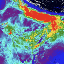
Key bands in the dataset include Aerosol Optical Depth at 0.47 μm and 0.55 μm, AOD Uncertainty, Fine Mode Fraction, and Column Water Vapor.
-
MODIS data and products from LP DAAC have no restrictions on subsequent use, sale, or redistribution.
-
The dataset can be explored and analyzed using the Google Earth Engine platform.
- Dataset Availability
- 2000-02-24T00:00:00Z–2025-11-14T23:15:00Z
- Dataset Provider
- NASA LP DAAC at the USGS EROS Center
- Cadence
- 1 Day
- Tags
Description
The MCD19A2 V6.1 data product is a MODIS Terra and Aqua combined Multi-angle Implementation of Atmospheric Correction (MAIAC) Land Aerosol Optical Depth (AOD) gridded Level 2 product produced daily at 1 km resolution. For more information see the MAIAC user guide .
NOTE: This product has been released with the caveat that the reprocessing for the full mission is expected to continue through summer 2023.
Bands
Pixel Size 1000 meters
Bands
Optical_Depth_047
Aerosol optical depth over land retrieved in the MODIS Blue band (0.47 μm). AOD is not received at high altitude (greater than 4.2 km) except when smoke or dust is detected; rather, we report a static value of 0.02 used for atmospheric correction.
Optical_Depth_055
Aerosol optical depth over land retrieved in the MODIS Green band (0.55 μm).
AOD_Uncertainty
AOD uncertainty based on blue-band surface brightness (reflectance)
FineModeFraction
Fine mode fraction for ocean and large inland lakes
Column_WV
Column water vapor over land, retrieved from MODIS near-IR bands at 0.94 μm. When reported for cloudy pixels, it represents water vapor above the cloud.
AOD_QA
AOD QA
Injection_Height
Smoke injection height
AngstromExp_470-780
Angstrom exponent 470-780nm over the ocean
cosSZA
Cosine of solar zenith angle (5 km resolution)
cosVZA
Cosine view zenith angle (5 km resolution)
RelAZ
Relative azimuth angle (5 km resolution)
Scattering_Angle
Scattering angle (5 km resolution)
Glint_Angle
Glint angle (5 km resolution)
Terms of Use
Terms of Use
MODIS data and products acquired through the LP DAAC have no restrictions on subsequent use, sale, or redistribution.
Citations
-
Please visit LP DAAC 'Citing Our Data' page for information on citing LP DAAC datasets.
DOIs
Explore with Earth Engine
Code Editor (JavaScript)
 var

 collection

 =

 ee
 .
 ImageCollection
 (
 'MODIS/061/MCD19A2_GRANULES'
 )

 .
 select
 (
 'Optical_Depth_047'
 )

 .
 filterDate
 (
 '2023-01-01'
 ,

 '2023-01-15'
 );
 var

 band_viz

 =

 {

 min
 :

 0
 ,

 max
 :

 1100
 ,

 palette
 :

 [
 'black'
 ,

 'blue'
 ,

 'purple'
 ,

 'cyan'
 ,

 'green'
 ,

 'yellow'
 ,

 'red'
 ]
 };
 Map
 .
 addLayer
 (
 collection
 .
 mean
 (),

 band_viz
 ,

 'Optical Depth 047'
 );
 Map
 .
 setCenter
 (
 76
 ,

 13
 ,

 6
 );