
AI-generated Key Takeaways
-
The Advanced Spaceborne Thermal Emission and Reflection Radiometer Global Emissivity Database (ASTER-GED) was developed by NASA's Jet Propulsion Laboratory.
-
This product includes data such as mean emissivity for ASTER Thermal Infrared bands, mean land surface temperature, a re-sampled ASTER GDEM, land-water mask, mean Normalized Difference Vegetation Index (NDVI), and observation count.
-
ASTER-GED land surface temperature and emissivity are generated using the ASTER Temperature Emissivity Separation (TES) algorithm combined with a Water Vapor Scaling atmospheric correction method.
-
This product was derived from clear-sky pixels from ASTER data collected between 2000 and 2008.
-
ASTER data and products from LP DAAC, excluding ASTER GDEM v2, have no restrictions on use, sale, or redistribution.
- Dataset Availability
- 2000-01-01T00:00:00Z–2008-12-31T00:00:00Z
- Dataset Provider
- NASA LP DAAC at the USGS EROS Center
- Tags
Description
The Advanced Spaceborne Thermal Emission and Reflection Radiometer Global Emissivity Database (ASTER-GED) was developed by the National Aeronautics and Space Administration's (NASA) Jet Propulsion Laboratory (JPL), California Institute of Technology. This product includes the mean emissivity and standard deviation for all 5 ASTER Thermal Infrared bands, mean land surface temperature (LST) and standard deviation, a re-sampled ASTER GDEM, land-water mask, mean Normalized Difference Vegetation Index (NDVI) and standard deviation, and observation count.
ASTER-GED land surface temperature and emissivity (LST&E) are generated using the ASTER Temperature Emissivity Separation (TES) algorithm in combination with a Water Vapor Scaling (WVS) atmospheric correction method using MODIS MOD07 atmospheric profiles and the MODTRAN 5.2 radiative transfer model.
This product was derived from clear-sky pixels for all available ASTER data (2000-2008).
Bands
Pixel Size 100 meters
Bands
| Name | Units | Min | Max | Scale | Pixel Size | Description |
|---|---|---|---|---|---|---|
emissivity_band10
|
0 | 1000 | 0.001 | meters | Mean band 10 |
|
emissivity_band11
|
0 | 1000 | 0.001 | meters | Mean band 11 |
|
emissivity_band12
|
0 | 1000 | 0.001 | meters | Mean band 12 |
|
emissivity_band13
|
0 | 1000 | 0.001 | meters | Mean band 13 |
|
emissivity_band14
|
0 | 1000 | 0.001 | meters | Mean band 14 |
|
emissivity_sdev_band10
|
-1000 | 1000 | 0.0001 | meters | Standard deviation band 10 |
|
emissivity_sdev_band11
|
-1000 | 1000 | 0.0001 | meters | Standard deviation band 11 |
|
emissivity_sdev_band12
|
-1000 | 1000 | 0.0001 | meters | Standard deviation band 12 |
|
emissivity_sdev_band13
|
-1000 | 1000 | 0.0001 | meters | Standard deviation band 13 |
|
emissivity_sdev_band14
|
-1000 | 1000 | 0.0001 | meters | Standard deviation band 14 |
|
temperature
|
K | 0 | 65535 | 0.01 | meters | Temperature mean |
temperature_sdev
|
K | 0 | 65535 | 0.01 | meters | Temperature standard deviation |
ndvi
|
0 | 100 | 0.01 | meters | NDVI mean |
|
ndvi_sdev
|
0 | 100 | 0.01 | meters | NDVI standard deviation |
|
elevation
|
m | -500 | 9000 | meters | ASTER Global Digital Elevation Model V002 |
|
land_water_map
|
meters | Land water map |
||||
num_obs
|
Number per pixel | 0* | 120* | meters | Number of observations |
land_water_map Class Table
| Value | Color | Description |
|---|---|---|
|
1
|
brown | Land |
|
2
|
blue | Water |
Terms of Use
Terms of Use
ASTER data and products distributed by the LP DAAC, with the exception of the ASTER Global Digital Elevation Model (GDEM) dataset (ASTGTM) version 2 (v2), have no restrictions on data use, sale, or subsequent redistribution. For more information visit the ASTER Policies site.
Citations
-
Please visit LP DAAC 'Citing Our Data' page for information on citing LP DAAC datasets.
DOIs
Explore with Earth Engine
Code Editor (JavaScript)
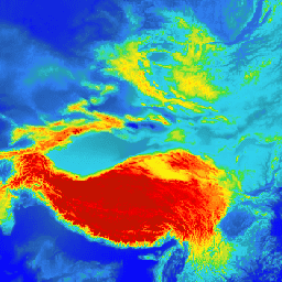
 var

 dataset

 =

 ee
 .
 Image
 (
 'NASA/ASTER_GED/AG100_003'
 );
 var

 elevation

 =

 dataset
 .
 select
 (
 'elevation'
 );
 var

 elevationVis

 =

 {

 min
 :

 -
 15.0
 ,

 max
 :

 5000.0
 ,

 palette
 :

 [

 '0602ff'
 ,

 '235cb1'
 ,

 '307ef3'
 ,

 '269db1'
 ,

 '30c8e2'
 ,

 '32d3ef'
 ,

 '3ae237'
 ,

 'b5e22e'
 ,

 'd6e21f'
 ,

 'fff705'
 ,

 'ffd611'
 ,

 'ffb613'
 ,

 'ff8b13'
 ,

 'ff6e08'
 ,

 'ff500d'
 ,

 'ff0000'
 ,

 'de0101'
 ,

 'c21301'

 ],
 };
 Map
 .
 setCenter
 (
 89.12
 ,

 37.72
 ,

 3
 );
 Map
 .
 addLayer
 (
 elevation
 ,

 elevationVis
 ,

 'Elevation'
 );