
Page Summary
-
The Formaldehyde Level 3 collection provides trace gas information on a regular grid derived from TEMPO observations.
-
This dataset includes information on formaldehyde vertical columns, ancillary data for calculations, and retrieval quality flags.
-
A version with QA filters is available, and general documentation is provided.
-
The dataset includes various bands measuring different parameters related to formaldehyde and atmospheric conditions.
-
This dataset is in the public domain and available without restriction on use and distribution.
- Dataset Availability
- 2023-08-01T00:00:00Z–2025-09-16T21:03:09Z
- Dataset Producer
- NASA ASDC
- Tags
Description
Formaldehyde Level 3 collection provides trace gas information on a regular grid covering the TEMPO field of regard for nominal TEMPO observations. Level 3 files are derived by combining information from all Level 2 files constituting a TEMPO East-West scan cycle. The rasters contain information on formaldehyde vertical columns, ancillary data used in air mass factor calculations and reference sector or de-striping corrections, and retrieval quality flags. The re-gridding algorithm uses an area-weighted approach.
- A version of this dataset with QA filters applied is available as NASA/TEMPO/HCHO_L3_QA
- General Documentation
Bands
Bands
Pixel size: 2226 meters (all bands)
| Name | Units | Pixel Size | Description |
|---|---|---|---|
weight
|
km^2 | 2226 meters | Sum of Level 2 pixel overlap areas. Represents the weighting factor for each grid cell, indicating the fraction of the grid cell area with valid data. |
vertical_column
|
molecules/cm^2 | 2226 meters | HCHO vertical column |
vertical_column_uncertainty
|
molecules/cm^2 | 2226 meters | HCHO vertical column uncertainty |
main_data_quality_flag
|
Dimensionless | 2226 meters | Main data quality flag. Provides an overall assessment of the data quality |
num_vertical_column_samples
|
Dimensionless | 2226 meters | Number of vertical column samples |
min_vertical_column_sample
|
molecules/cm^2 | 2226 meters | Smallest vertical column sample |
max_vertical_column_sample
|
molecules/cm^2 | 2226 meters | Largest vertical column sample |
solar_zenith_angle
|
deg | 2226 meters | Solar zenith angle at pixel center |
viewing_zenith_angle
|
deg | 2226 meters | Viewing zenith angle at pixel center |
relative_azimuth_angle
|
deg | 2226 meters | Relative azimuth angle at pixel center |
surface_pressure
|
hPa | 2226 meters | Surface pressure |
terrain_height
|
m | 2226 meters | Terrain height |
snow_ice_fraction
|
Dimensionless | 2226 meters | Fraction of pixel area covered by snow and/or ice |
fitted_slant_column
|
molecules/cm^2 | 2226 meters | HCHO fitted slant column |
fitted_slant_column_uncertainty
|
molecules/cm^2 | 2226 meters | HCHO fitted slant column uncertainty |
albedo
|
Dimensionless | 2226 meters | Surface albedo |
amf
|
Dimensionless | 2226 meters | HCHO air mass factor |
eff_cloud_fraction
|
Dimensionless | 2226 meters | Effective cloud fraction |
amf_cloud_fraction
|
Dimensionless | 2226 meters | Cloud radiance fraction for AMF calculation |
amf_cloud_pressure
|
hPa | 2226 meters | Cloud pressure for AMF calculation |
main_data_quality_flag Class Table
| Value | Color | Description |
|---|---|---|
|
0
|
None | good |
|
1
|
None | suspect |
|
2
|
None | bad |
Terms of Use
Terms of Use
This dataset is in the public domain and is available without restriction on use and distribution. See NASA's Earth Science Data & Information Policy for additional information.
Citations
-
NASA/LARC/SD/ASDC. (n.d.). TEMPO gridded HCHO vertical columns V03 (PROVISIONAL) [Data set]. NASA Langley Atmospheric Science Data Center DAAC. Retrieved from https://doi.org/10.5067/IS-40e/TEMPO/HCHO_L3.003
DOIs
Explore with Earth Engine
Code Editor (JavaScript)
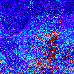
 var

 collection

 =

 ee
 .
 ImageCollection
 (
 'NASA/TEMPO/HCHO_L3'
 )

 .
 filterDate
 (
 '2024-04-01'
 ,

 '2024-04-05'
 )
 var

 visParams

 =

 {

 min
 :

 0
 ,

 max
 :

 1.5e16
 ,

 bands
 :

 [
 'vertical_column'
 ],

 palette
 :

 [

 '000080'
 ,

 '0000D9'
 ,

 '4000FF'
 ,

 '8000FF'
 ,

 '0080FF'
 ,

 '00D9FF'
 ,

 '80FFFF'
 ,

 'FF8080'
 ,

 'D90000'
 ,

 '800000'

 ]
 };
 Map
 .
 setCenter
 (
 -
 95.06
 ,

 42.02
 ,

 3
 )
 Map
 .
 addLayer
 (
 collection
 ,

 visParams
 ,

 'HCHO vertical column'
 )