
AI-generated Key Takeaways
-
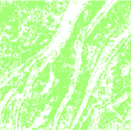
This dataset is a 30 meter resolution map of terraces in China for the year 2018, created using supervised pixel-based classification on multisource and multi-temporal data via the Google Earth Engine platform.
-
The map distinguishes between areas with and without terraces, represented by values 1 and 0 respectively, in the 'terrace' band.
-
The dataset achieved an overall accuracy of 94% and a kappa coefficient of 0.72, making it useful for various studies like soil erosion and food security.
- Dataset Availability
- 2018-01-01T00:00:00Z–2019-01-01T00:00:00Z
- Dataset Provider
- Department of Earth System Science, Tsinghua University (DESS, THU)
- Tags
Description
This dataset is a China terrace map at 30 m resolution in 2018. It was developed through supervised pixel-based classification using multisource and multi-temporal data based on the Google Earth Engine platform. The overall accuracy and kappa coefficient achieved 94% and 0.72, respectively. This first 30 m China terrace map can be used for studies on soil erosion, food security, biogeochemical cycle, biodiversity, and ecosystem service assessments.
Bands
Bands
| Name | Pixel Size | Description |
|---|---|---|
terrace
|
30 meters | 1 when a terrace is present, 0 when it is not. |
terrace Class Table
| Value | Color | Description |
|---|---|---|
|
0
|
#ffffff | No terraces |
|
1
|
#a3ff74 | Terraces present |
Terms of Use
Terms of Use
Citations
-
Cao, B., Yu, L., Naipal, V., Ciais, P., Li, W., Zhao, Y., Wei, W., Chen, D., Liu, Z., and Gong, P.: A 30 m terrace mapping in China using Landsat 8 imagery and digital elevation model based on the Google Earth Engine, Earth Syst. Sci. Data, 13, 2437-2456, doi:10.5194/essd-13-2437-2021 , 2021.
DOIs
Explore with Earth Engine
Code Editor (JavaScript)
 var

 image

 =

 ee
 .
 Image
 (
 'Tsinghua/DESS/ChinaTerraceMap/v1'
 );
 var

 image

 =

 image
 .
 updateMask
 (
 image
 );
 Map
 .
 addLayer
 (
 image
 ,

 {
 min
 :

 0
 ,

 max
 :

 1
 ,

 palette
 :

 [
 'a3ff74'
 ]},

 'Terraces'
 );
 Map
 .
 setCenter
 (
 106.6
 ,

 30.4
 ,

 10
 );
 Map
 .
 setOptions
 (
 'SATELLITE'
 );