
AI-generated Key Takeaways
-
The Murray Global Intertidal Change Dataset provides global maps of tidal flat ecosystems generated from Landsat images between 1984 and 2016.
-
The dataset classifies each pixel into tidal flat, permanent water, or other based on supervised classification and training data.
-
The data is available as a time-series of 11 global maps at 30m resolution for defined time periods.
-
A data mask band is included to indicate areas where the tidal flat classifier was implemented.
-
This dataset is licensed under a Creative Commons Attribution 4.0 International License and requires proper citation.
- Dataset Availability
- 1984-01-01T00:00:00Z–2017-01-01T00:00:00Z
- Dataset Provider
- Murray/UQ/Google/USGS/NASA
- Tags
Description
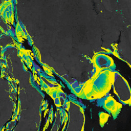
The Murray Global Intertidal Change Dataset contains global maps of tidal flat ecosystems produced via a supervised classification of 707,528 Landsat Archive images. Each pixel was classified into tidal flat, permanent water or other with reference to a globally distributed set of training data.
The classification was implemented along the entire global coastline between 60° North and 60° South from 1 January 1984 to 31 December 2016. The image collection consists consists of a time-series of 11 global maps of tidal flats at 30m pixel resolution for set time-periods (1984-1986; 1987-1989; 1990-1992; 1993-1995; 1996-1998; 1999-2001; 2002-2004; 2005-2007; 2008-2010; 2011-2013; 2014-2016)
Flag indicating the spatial limits of the implementation of the tidal flat classifier as defined by altitudinal (+100m) and bathymetric (-100m) limits.
Bands
Pixel Size 30 meters
Bands
datamask
A flag to indicate data inclusion.
Terms of Use
Terms of Use
This work is licensed under a Creative Commons Attribution 4.0 International License.
Any use of the intertidal data must include proper acknowledgement, including citing the associated journal article.
Citations
-
Murray, N.J., Phinn, S.R., DeWitt, M., Ferrari, R., Johnston, R., Lyons, M.B., Clinton, N., Thau, D. & Fuller, R.A. (2019) The global distribution and trajectory of tidal flats. Nature, 565, 222-225. doi:10.1038/s41586-018-0805-8 ,
-
Murray, N. J., Phinn, S. P., Fuller, R. A., DeWitt, M., Ferrari, R., Johnston, R., Clinton, N., & Lyons, M. B. (2022). High-resolution global maps of tidal flat ecosystems from 1984 to 2019. Scientific Data, 9(1). doi:10.1038/s41597-022-01635-5 ,
DOIs
Explore with Earth Engine
Code Editor (JavaScript)
 var

 dataset

 =

 ee
 .
 Image
 (
 'UQ/murray/Intertidal/v1_1/data_mask'
 );
 var

 visualization

 =

 {

 bands
 :

 [
 'datamask'
 ],

 min
 :

 0
 ,

 max
 :

 1
 ,

 palette
 :

 [
 '000000'
 ,

 'ffffff'
 ]
 };
 Map
 .
 setCenter
 (
 126.6339
 ,

 37.4394
 ,

 10
 );
 Map
 .
 addLayer
 (
 dataset
 ,

 visualization
 ,

 'Data mask'
 );