
Get started
Before you can try the sample code, you must configure your development environment. For more information, see Set up a Flutter project .
View the code
Dart
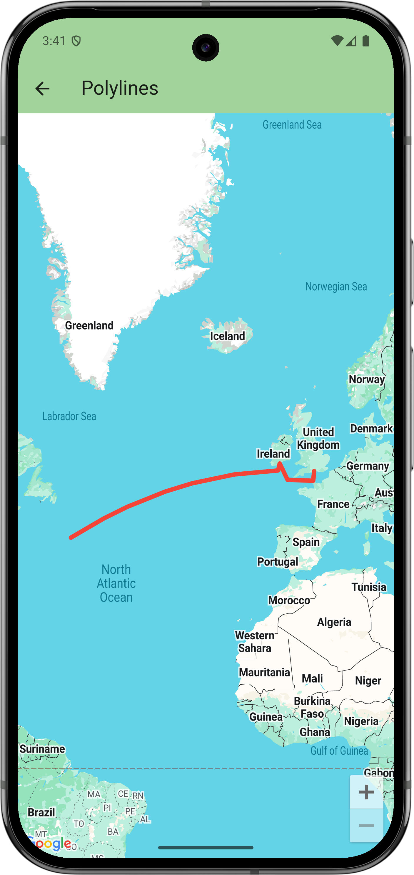
// Copyright 2025 Google LLC // // Licensed under the Apache License , Version 2.0 ( the "License" ); // you may not use this file except in compliance with the License . // You may obtain a copy of the License at // // https : // www . apache . org / licenses / LICENSE - 2.0 // // Unless required by applicable law or agreed to in writing , software // distributed under the License is distributed on an "AS IS" BASIS , // WITHOUT WARRANTIES OR CONDITIONS OF ANY KIND , either express or implied . // See the License for the specific language governing permissions and // limitations under the License . import 'package:flutter/material.dart' ; import 'package:google_maps_flutter/google_maps_flutter.dart' ; /// Displays a map of the North Atlantic Ocean with the route of the Titanic /// marked on it . class PolylinesSample extends StatelessWidget { const PolylinesSample ({ super . key }); @override Widget build ( BuildContext context ) { return GoogleMap ( initialCameraPosition : CameraPosition ( target : LatLng ( 49 , - 23 )), polylines : { Polyline ( // Polyline id must be unique . polylineId : PolylineId ( 'titanic route' ), points : [ LatLng ( 50.90 , - 1.41 ), // Southampton LatLng ( 49.65 , - 1.60 ), // Cherbourg LatLng ( 49.77 , - 6.71 ), LatLng ( 51.83 , - 8.28 ), // Cobh LatLng ( 50.96 , - 8.58 ), LatLng ( 41.75 , - 49.90 ), // Wreck ], width : 5 , color : Colors . red , geodesic : true , // Custom caps and joint types aren 't supported on all platforms. startCap : Cap . roundCap , endCap : Cap . roundCap , jointType : JointType . round , consumeTapEvents : true , onTap : () = > debugPrint ( 'clicked route' ), ), }, ); } }
Next steps
View the complete set of samples on GitHub:
Alternatively, clone the full set of samples to run them locally by executing the following commands:
git clone -b flutter_samples https://github.com/googlemaps-samples/flutter-maps-samples.gitcd flutter-samplesflutter pub get