
Page Summary
-
The Open Buildings Temporal V1 dataset provides annual building data from 2016-2023 with information on presence, fractional count, and height.
-
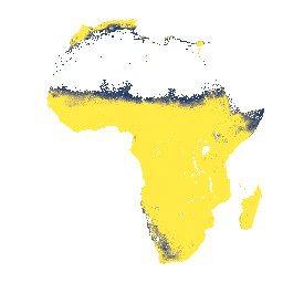
The Open Buildings V3 Polygons dataset contains over 1.8 billion building outlines derived from high-resolution satellite imagery across Africa, Latin America, the Caribbean, and parts of Asia.
-
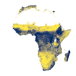
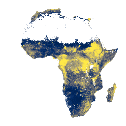
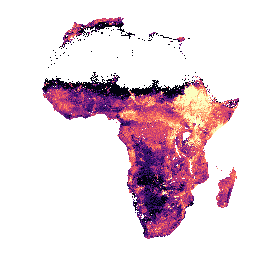
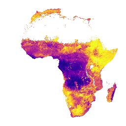
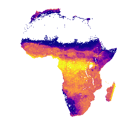
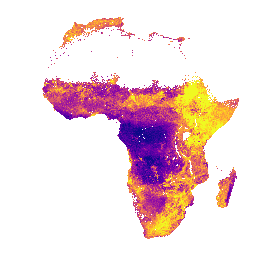
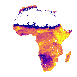
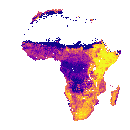
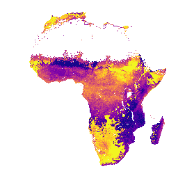
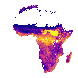
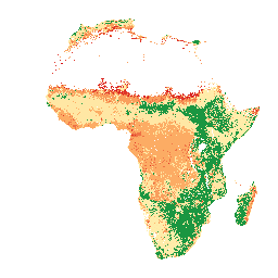
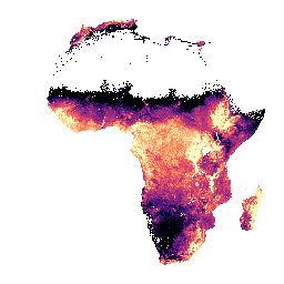
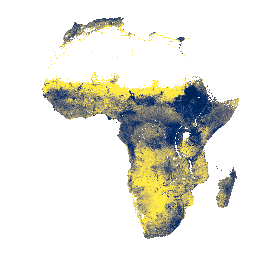
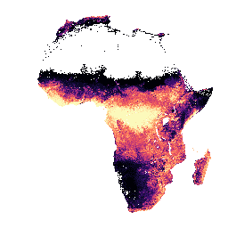
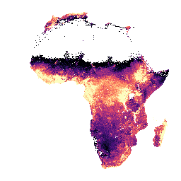
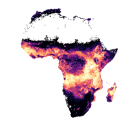
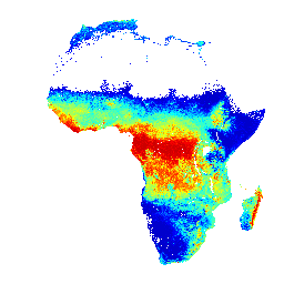
The iSDAsoil datasets offer various soil property predictions for Africa at different soil depths, including bulk density, clay content, depth to bedrock, cation exchange capacity, extractable elements, fertility capability classification, organic and total carbon, total nitrogen, sand/silt/stone content, and pH.
-
iSDAsoil data is based on machine learning coupled with 30m pixel size and includes predicted mean and standard deviation, with notes on potential accuracy issues in dense jungle areas.
-
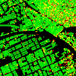
Open Buildings Temporal V1
The Open Buildings 2.5D Temporal Dataset contains data about building presence, fractional building counts, and building heights at an effective1 spatial resolution of 4m (rasters are provided at 0.5m resolution) at an annual cadence from 2016-2023. It is produced from open-source, low-resolution imagery from the … africa annual asia built-up height open-buildings -
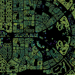
Open Buildings V3 Polygons
This large-scale open dataset consists of outlines of buildings derived from high-resolution 50 cm satellite imagery. It contains 1.8B building detections in Africa, Latin America, Caribbean, South Asia and Southeast Asia. The inference spanned an area of 58M km². For each building in this dataset … africa asia building built-up open-buildings population -
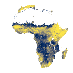
iSDAsoil Bulk Density, <2mm Fraction
Bulk density, <2mm fraction at soil depths of 0-20 cm and 20-50 cm, predicted mean and standard deviation. Pixel values must be back-transformed with x/100. In areas of dense jungle (generally over central Africa), model accuracy is low and therefore artifacts such as banding (striping) … africa isda soil -
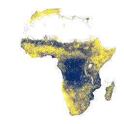
iSDAsoil Clay Content
Clay content at soil depths of 0-20 cm and 20-50 cm,\npredicted mean and standard deviation. In areas of dense jungle (generally over central Africa), model accuracy is low and therefore artifacts such as banding (striping) might be seen. Soil property predictions were made by Innovative … africa clay isda soil -
iSDAsoil Depth to Bedrock
Depth to bedrock at 0-200 cm depth, predicted mean and standard deviation. Due to the potential cropland mask that was used for generating the data, many areas of exposed rock (where depth to bedrock would be 0 cm) have been masked out and therefore appear … africa bedrock isda soil -
iSDAsoil Effective Cation Exchange Capacity
Effective Cation Exchange Capacity predicted mean and standard deviation at soil depths of 0-20 cm and 20-50 cm, Pixel values must be back-transformed with exp(x/10)-1. In areas of dense jungle (generally over central Africa), model accuracy is low and therefore artifacts such as banding (striping) … africa aluminium isda soil -
iSDAsoil Extractable Calcium
Extractable calcium at soil depths of 0-20 cm and 20-50 cm, predicted mean and standard deviation. Pixel values must be back-transformed with exp(x/10)-1. In areas of dense jungle (generally over central Africa), model accuracy is low and therefore artifacts such as banding (striping) might be … africa isda soil -
iSDAsoil Extractable Iron
Extractable iron at soil depths of 0-20 cm and 20-50 cm, predicted mean and standard deviation. Pixel values must be back-transformed with exp(x/10)-1. In areas of dense jungle (generally over central Africa), model accuracy is low and therefore artifacts such as banding (striping) might be … africa isda soil -
iSDAsoil Extractable Magnesium
Extractable magnesium at soil depths of 0-20 cm and 20-50 cm, predicted mean and standard deviation. Pixel values must be back-transformed with exp(x/10)-1. In areas of dense jungle (generally over central Africa), model accuracy is low and therefore artifacts such as banding (striping) might be … africa isda soil -
iSDAsoil Extractable Phosphorus
Extractable phosphorus at soil depths of 0-20 cm and 20-50 cm, predicted mean and standard deviation. Pixel values must be back-transformed with exp(x/10)-1. In areas of dense jungle (generally over central Africa), model accuracy is low and therefore artifacts such as banding (striping) might be … africa isda soil -
iSDAsoil Extractable Potassium
Extractable potassium at soil depths of 0-20 cm and 20-50 cm, predicted mean and standard deviation. Pixel values must be back-transformed with exp(x/10)-1. In areas of dense jungle (generally over central Africa), model accuracy is low and therefore artifacts such as banding (striping) might be … africa isda soil -
iSDAsoil Extractable Sulfur
Extractable sulfur at soil depths of 0-20 cm and 20-50 cm, predicted mean and standard deviation. Pixel values must be back-transformed with exp(x/10)-1. In areas of dense jungle (generally over central Africa), model accuracy is low and therefore artifacts such as banding (striping) might be … africa isda soil -
iSDAsoil Extractable Zinc
Extractable zinc at soil depths of 0-20 cm and 20-50 cm, predicted mean and standard deviation. Pixel values must be back-transformed with exp(x/10)-1. In areas of dense jungle (generally over central Africa), model accuracy is low and therefore artifacts such as banding (striping) might be … africa isda soil -
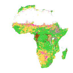
iSDAsoil Fertility Capability Classification
Soil fertility capability classification derived using slope, chemical, and physical soil properties. For more information about this layer, please visit this page. The classes for the 'fcc' band apply to pixel values that must be back-transformed with x modulo 3000. In areas of dense jungle … africa isda soil -
iSDAsoil Organic Carbon
Organic carbon at soil depths of 0-20 cm and 20-50 cm, predicted mean and standard deviation. Pixel values must be back-transformed with exp(x/10)-1. In areas of dense jungle (generally over central Africa), model accuracy is low and therefore artifacts such as banding (striping) might be … africa carbon isda soil -
iSDAsoil Sand Content
Sand content at soil depths of 0-20 cm and 20-50 cm,\npredicted mean and standard deviation. In areas of dense jungle (generally over central Africa), model accuracy is low and therefore artifacts such as banding (striping) might be seen. Soil property predictions were made by Innovative … africa isda sand soil -
iSDAsoil Silt Content
Silt content at soil depths of 0-20 cm and 20-50 cm, predicted mean and standard deviation. Pixel values must be back-transformed with exp(x/10)-1. In areas of dense jungle (generally over central Africa), model accuracy is low and therefore artifacts such as banding (striping) might be … africa isda soil -
iSDAsoil Stone Content
Stone content at soil depths of 0-20 cm and 20-50 cm, predicted mean and standard deviation. Pixel values must be back-transformed with exp(x/10)-1. In areas of dense jungle (generally over central Africa), model accuracy is low and therefore artifacts such as banding (striping) might be … africa isda soil -
iSDAsoil Total Carbon
Total carbon at soil depths of 0-20 cm and 20-50 cm, predicted mean and standard deviation. Pixel values must be back-transformed with exp(x/10)-1. In areas of dense jungle (generally over central Africa), model accuracy is low and therefore artifacts such as banding (striping) might be … africa aluminium isda soil -
iSDAsoil Total Nitrogen
Total nitrogen at soil depths of 0-20 cm and 20-50 cm, predicted mean and standard deviation. Pixel values must be back-transformed with exp(x/100)-1. In areas of dense jungle (generally over central Africa), model accuracy is low and therefore artifacts such as banding (striping) might be … africa isda nitrogen soil -
iSDAsoil USDA Texture Class
USDA Texture Class at soil depths of 0-20 cm and 20-50 cm. In areas of dense jungle (generally over central Africa), model accuracy is low and therefore artifacts such as banding (striping) might be seen. Soil property predictions were made by Innovative Solutions for Decision … africa aluminium isda soil -
iSDAsoil extractable Aluminium
Extractable aluminium at soil depths of 0-20 cm and 20-50 cm, predicted mean and standard deviation. Pixel values must be back-transformed with exp(x/10)-1. Soil property predictions were made by Innovative Solutions for Decision Agriculture Ltd. (iSDA) at 30 m pixel size using machine learning coupled … africa aluminium isda soil -
iSDAsoil pH
pH at soil depths of 0-20 cm and 20-50 cm, predicted mean and standard deviation. Pixel values must be back-transformed with x/10. In areas of dense jungle (generally over central Africa), model accuracy is low and therefore artifacts such as banding (striping) might be seen. … africa isda ph soil