
Page Summary
-
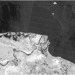
The JAXA/ALOS/PALSAR-2/Level2_2/ScanSAR dataset contains 25m normalized backscatter SAR imagery with an observation width of 350 km, ortho-rectified and slope corrected using the ALOS World 3D - 30m Digital Surface Model.
-
The dataset is available from 2014-08-04 to 2025-09-30 and is provided by JAXA EORC.
-
Polarization data is stored as 16-bit digital numbers (DN) and can be converted to gamma naught values in decibels using a specified equation.
-
Level 2.2 data is ortho-rectified, radiometrically terrain-corrected, and compatible with the CEOS Analysis Ready Data for LAND (CARD4L) standard.
-
The dataset includes bands for HH and HV polarization, local incidence angle, and a data quality bitmask.
- Dataset Availability
- 2014-08-04T00:00:00Z–2026-05-15T16:51:15.802000Z
- Dataset Producer
- JAXA EORC
- Tags
Description
The 25 m PALSAR-2 ScanSAR is normalized backscatter data of PALSAR-2 broad area observation mode with observation width of 350 km. The SAR imagery was ortho-rectificatied and slope corrected using the ALOS World 3D - 30 m (AW3D30) Digital Surface Model. Polarization data are stored as 16-bit digital numbers (DN). The DN values can be converted to gamma naught values in decibel unit (dB) using the following equation:
- γ 0 = 10*log 10 (DN 2 ) - 83.0 dB
Level 2.2 data are ortho-rectified and radiometrically terrain-corrected.
This dataset is compatible with the Committee on Earth Observation (CEOS) Analysis Ready Data for LAND (CARD4L) standard.
Note that this collection is heterogeneous and contains a mixture of
single-polarization (HH) and dual-polarization (HH+HV, and rarely VV+VH)
images. Users should filter the collection by the Polarizations
property
before selecting polarization bands (e.g., collection.filter(ee.Filter.listContains('Polarizations', 'HV'))
).
Bands
Bands
Pixel size: 25 meters (all bands)
HH
HH polarization Terrain-flattened Gamma-Nought backscatter coefficient.
HV
HV polarization Terrain-flattened Gamma-Nought backscatter coefficient.
VV
VV polarization Terrain-flattened Gamma-Nought backscatter coefficient.
VH
VH polarization Terrain-flattened Gamma-Nought backscatter coefficient.
LIN
Local incidence angle. The angle formed by the radar irradiation direction and the normal of the slope.
MSK
Data quality bitmask.
Image Properties
Image Properties
| Name | Type | Description |
|---|---|---|
|
AntennaPointing
|
STRING | Antenna pointing direction ("Right" or "Left"). |
|
AzimuthPixelSpacing
|
DOUBLE | Azimuth pixel spacing. |
|
AzimuthResolution
|
DOUBLE | Azimuth resolution. |
|
BeamID
|
STRING | Beam ID. |
|
DataAccess_ProcessingTime
|
STRING | Processing time of this product (ISO8601 string). |
|
DataAccess_SoftwareVersion
|
STRING | Software version of this product. |
|
DigitalElevationModel
|
STRING | Type of DEM used ("Elevation" or "Surface"). |
|
EasternBias
|
DOUBLE | Bias of easting error. |
|
EasternSTDev
|
DOUBLE | Standard deviation of easting error. |
|
Easting_LR
|
DOUBLE | Easting of Lower Right of Product. |
|
Easting_UL
|
DOUBLE | Easting of upper left of product. |
|
Estimates_HH
|
DOUBLE | Estimated HH value in Noise Equivalent Intensity (NESZ). |
|
Estimates_HV
|
DOUBLE | Estimated HV value in Noise Equivalent Intensity (NESZ). |
|
FilterApplied
|
STRING | Whether a filter was applied ("TRUE" or "FALSE"). |
|
FilterType
|
STRING | Filter type (N/A if no filtering was applied). |
|
FirstAcquisitionDate
|
STRING | Observation date of the first acquisition (ISO8601 string). |
|
IDCMethod
|
STRING | Ionospheric delay correction ("TEC model" or "Coregistration"). |
|
IncAngleFarRange
|
DOUBLE | Incident angle in far range. |
|
IncAngleNearRange
|
DOUBLE | Incident angle in near range. |
|
IonosphericDelayCorrectionApplied
|
DOUBLE | Whether ionospheric delay correction was applied ("TRUE" or "FALSE"). |
|
LastAcquisitionDate
|
STRING | Observation date of the last acquisition (ISO 8601 string). |
|
NRAlgorithm
|
STRING | Noise removal algorithm. |
|
NoiseRemovalApplied
|
STRING | Whether noise removal algorithm was applied ("TRUE" or "FALSE"). |
|
NorthernBias
|
DOUBLE | Bias of northing error. |
|
NorthernSTDev
|
DOUBLE | Standard deviation of northing error. |
|
Northing_LR
|
DOUBLE | Northing of lower right of product. |
|
Northing_UL
|
DOUBLE | Northing of upper left of product. |
|
ObservationMode
|
STRING | Observation mode. |
|
OrbitDataSource
|
STRING | Orbit data source (e.g., predicted, definite, precise, downlinked). |
|
PassDirection
|
STRING | Pass direction ("Ascending" or "Descending"). |
|
Polarizations
|
STRING_LIST | Transmit/Receive polarisation for the data. There is one element for each Tx/Rx combination: ['VV'], ['HH'], ['VV', 'VH'], or ['HH', 'HV']. |
|
ProductColumnSpacing
|
DOUBLE | Product column spacing. |
|
ProductRowSpacing
|
DOUBLE | Product row spacing. |
|
Product_Version
|
DOUBLE | Product version. |
|
RSP_Frame_Number
|
INT | Scene frame number. |
|
RSP_Path_Number
|
INT | Scene path number. |
|
RadarCenterFrequency
|
DOUBLE | Center frequency. |
|
RangePixelSpacing
|
DOUBLE | Range pixel spacing. |
|
RangeResolution
|
INT | Range resolution. |
|
SlantRangeCorrection
|
INT_LIST | The correction for each scan described from the first scan. |
|
SourceProcParam_ProcessingDate
|
STRING | Processing date of the source product (ISO8601 string). |
|
SourceProcParam_ProcessingFacility
|
STRING | Processing facility of the source product. |
|
SourceProcParam_ProductID
|
STRING | Product ID of the source product. |
|
SourceProcParam_SoftwareVersion
|
DOUBLE | Software version of the source product. |
Terms of Use
Terms of Use
Anyone can use this data free of charge subject to the to the attribution requirements. For detailed terms of use see JAXA G-Portal Terms of service (Section 7. Condition concerning of G-Portal data).
Citations
-
The data used for this paper have been provided by Earth Observation Research Center (EORC) of Japan Aerospace Exploration Agency (JAXA).
Explore with Earth Engine
Code Editor (JavaScript)
 var

 collection

 =

 ee
 .
 ImageCollection
 (
 'JAXA/ALOS/PALSAR-2/Level2_2/ScanSAR'
 )

 .
 filterBounds
 (
 ee
 .
 Geometry
 .
 Point
 (
 143
 ,

 -
 5
 ));
 var

 image

 =

 collection
 .
 first
 ();
 Map
 .
 addLayer
 (
 image
 .
 select
 ([
 'HH'
 ]),

 {
 min
 :

 0
 ,

 max
 :

 8000
 },

 'HH polarization'
 );
 Map
 .
 centerObject
 (
 image
 );
 import

 ee
 import

 geemap.core

 as

 geemap
Colab (Python)
 collection
 =
 ee
 .
 ImageCollection
 (
 'JAXA/ALOS/PALSAR-2/Level2_2/ScanSAR'
 )
 .
 filterBounds
 (
 ee
 .
 Geometry
 .
 Point
 (
 143
 ,
 -
 5
 ))
 image
 =
 collection
 .
 first
 ()
 m
 =
 geemap
 .
 Map
 ()
 m
 .
 add_layer
 (
 image
 .
 select
 ([
 'HH'
 ]),
 {
 'min'
 :
 0
 ,
 'max'
 :
 8000
 },
 'HH polarization'
 )
 m
 .
 center_object
 (
 image
 )
 m