
Page Summary
-
The GEDI Level 2B Canopy Cover and Vertical Profile Metrics product (GEDI02_B) provides biophysical metrics extracted from GEDI waveforms.
-
This dataset is a raster version of the original GEDI02_B product, organized as monthly composites of individual orbits.
-
The dataset includes root-level cover, pai, and pavd values, along with associated quality flags and metadata, presented as 109 raster bands.
-
Data is available from 2019-03-25 to 2024-12-01 and is provided by Google, USFS Laboratory for Applications of Remote Sensing in Ecology (LARSE), and NASA GEDI mission.
- Dataset Availability
- 2019-03-25T00:00:00Z–2024-12-01T08:00:00Z
- Dataset Provider
- Rasterization: Google and USFS Laboratory for Applications of Remote Sensing in Ecology (LARSE) NASA GEDI mission, accessed through the USGS LP DAAC
- Tags
Description
GEDI Level 2B Canopy Cover and Vertical Profile Metrics product (GEDI02_B) extracts biophysical metrics from each GEDI waveform. These metrics are based on the directional gap probability profile derived from the L1B waveform.
The vertical step between foliage profile measurements (known as dZ in GEDI documentation) is always 5 meters.
The dataset LARSE/GEDI/GEDI02_B_002_MONTHLY is a raster version of the original GEDI02_B product. The raster images are organized as monthly composites of individual orbits in the corresponding month. Only root-level cover, pai and pavd values and their associated quality flags and metadata are preserved as raster bands. Each GEDI02_B_002 raster has 109 bands.
See User Guide for more information.
The Global Ecosystem Dynamics Investigation GEDI mission aims to characterize ecosystem structure and dynamics to enable radically improved quantification and understanding of the Earth's carbon cycle and biodiversity. The GEDI instrument, attached to the International Space Station (ISS), collects data globally between 51.6° N and 51.6° S latitudes at the highest resolution and densest sampling of the 3-dimensional structure of the Earth. The GEDI instrument consists of three lasers producing a total of eight beam ground transects, which instantaneously sample eight ~25 m footprints spaced approximately every 60 m along-track.
| Product | Description |
|---|---|
| L2A Vector | LARSE/GEDI/GEDI02_A_002 |
| L2A Monthly raster | LARSE/GEDI/GEDI02_A_002_MONTHLY |
| L2A table index | LARSE/GEDI/GEDI02_A_002_INDEX |
| L2B Vector | LARSE/GEDI/GEDI02_B_002 |
| L2B Monthly raster | LARSE/GEDI/GEDI02_B_002_MONTHLY |
| L2B table index | LARSE/GEDI/GEDI02_B_002_INDEX |
| L4A Biomass Vector | LARSE/GEDI/GEDI04_A_002 |
| L4A Monthly raster | LARSE/GEDI/GEDI04_A_002_MONTHLY |
| L4A table index | LARSE/GEDI/GEDI04_A_002_INDEX |
| L4B Biomass | LARSE/GEDI/GEDI04_B_002 |
Bands
Pixel Size 25 meters
Bands
algorithmrun_flag
The L2B algorithm is run if this flag is set to 1 indicating data have sufficient waveform fidelity for L2B to run.
beam
Beam number
cover
Total canopy cover
degrade_flag
Flag indicating degraded state of pointing and/or positioning information.
- 3X - ADF CHU solution unavailable (ST-2)
- 4X - Platform attitude
- 5X - Poor solution (filter covariance large)
- 6X - Data outage (platform attitude gap also)
- 7X - ST 1+2 unavailable (similar boresight FOV)
- 8X - ST 1+2+3 unavailable
- 9X - ST 1+2+3 and ISS unavailable
- X1 - Maneuver
- X2 - GPS data gap
- X3 - ST blinding
- X4 - Other
- X5 - GPS receiver clock drift
- X6 - Maneuver & GPS receiver clock drift
- X7 - GPS data gap & GPS receiver clock drift
- X8 - ST blinding & GPS receiver clock drift
- X9 - Other & GPS receiver clock drift
delta_time
Transmit time of the shot, measured in seconds from the master_time_epoch since 2018-01-01
fhd_normal
Foliage Height Diversity
l2b_quality_flag
L2B quality flag
local_beam_azimuth
Azimuth of the unit pointing vector for the laser in the local ENU frame measured from North and positive towards East.
local_beam_elevation
Elevation of the unit pointing vector for the laser in the local ENU frame measured from East-North plane and positive towards Up.
pai
Total Plant Area Index
pgap_theta
Total Gap Probability (theta)
selected_l2a_algorithm
Selected L2A algorithm setting
selected_rg_algorithm
Selected R (ground) algorithm
sensitivity
Maxmimum canopy cover that can be penetrated. Valid range is [0, 1]. Values outside of this range may be present but must be ignored. They represent noise and non-land surface waveforms.
solar_azimuth
The azimuth of the sun position vector from the laser bounce point position in the local ENU frame measured from North and is positive towards East.
solar_elevation
The elevation of the sun position vector from the laser bounce point position in the local ENU frame measured from the East-North plane and is positive Up.
shot_number
Shot number, a unique identifier. This field has the format of OOOOOBBRRGNNNNNNNN, where:
- OOOOO: Orbit number
- BB: Beam number
- RR: Reserved for future use
- G: Sub-orbit granule number
- NNNNNNNN: Shot index
shot_number_within_beam
Shot number within beam
cover_z0
Cumulative canopy cover vertical profile at 0%
cover_z1
Cumulative canopy cover vertical profile at 1%
cover_z2
Cumulative canopy cover vertical profile at 2%
cover_z3
Cumulative canopy cover vertical profile at 3%
cover_z4
Cumulative canopy cover vertical profile at 4%
cover_z5
Cumulative canopy cover vertical profile at 5%
cover_z6
Cumulative canopy cover vertical profile at 6%
cover_z7
Cumulative canopy cover vertical profile at 7%
cover_z8
Cumulative canopy cover vertical profile at 8%
cover_z9
Cumulative canopy cover vertical profile at 9%
cover_z10
Cumulative canopy cover vertical profile at 10%
cover_z11
Cumulative canopy cover vertical profile at 11%
cover_z12
Cumulative canopy cover vertical profile at 12%
cover_z13
Cumulative canopy cover vertical profile at 13%
cover_z14
Cumulative canopy cover vertical profile at 14%
cover_z15
Cumulative canopy cover vertical profile at 15%
cover_z16
Cumulative canopy cover vertical profile at 16%
cover_z17
Cumulative canopy cover vertical profile at 17%
cover_z18
Cumulative canopy cover vertical profile at 18%
cover_z19
Cumulative canopy cover vertical profile at 19%
cover_z20
Cumulative canopy cover vertical profile at 20%
cover_z21
Cumulative canopy cover vertical profile at 21%
cover_z22
Cumulative canopy cover vertical profile at 22%
cover_z23
Cumulative canopy cover vertical profile at 23%
cover_z24
Cumulative canopy cover vertical profile at 24%
cover_z25
Cumulative canopy cover vertical profile at 25%
cover_z26
Cumulative canopy cover vertical profile at 26%
cover_z27
Cumulative canopy cover vertical profile at 27%
cover_z28
Cumulative canopy cover vertical profile at 28%
cover_z29
Cumulative canopy cover vertical profile at 29%
cover_z30
Cumulative canopy cover vertical profile at 30%
pai_z0
Plant Area Index profile in 0 m²/m²
pai_z1
Plant Area Index profile in 1 m²/m²
pai_z2
Plant Area Index profile in 2 m²/m²
pai_z3
Plant Area Index profile in 3 m²/m²
pai_z4
Plant Area Index profile in 4 m²/m²
pai_z5
Plant Area Index profile in 5 m²/m²
pai_z6
Plant Area Index profile in 6 m²/m²
pai_z7
Plant Area Index profile in 7 m²/m²
pai_z8
Plant Area Index profile in 8 m²/m²
pai_z9
Plant Area Index profile in 9 m²/m²
pai_z10
Plant Area Index profile in 10 m²/m²
pai_z11
Plant Area Index profile in 11 m²/m²
pai_z12
Plant Area Index profile in 12 m²/m²
pai_z13
Plant Area Index profile in 13 m²/m²
pai_z14
Plant Area Index profile in 14 m²/m²
pai_z15
Plant Area Index profile in 15 m²/m²
pai_z16
Plant Area Index profile in 16 m²/m²
pai_z17
Plant Area Index profile in 17 m²/m²
pai_z18
Plant Area Index profile in 18 m²/m²
pai_z19
Plant Area Index profile in 19 m²/m²
pai_z20
Plant Area Index profile in 20 m²/m²
pai_z21
Plant Area Index profile in 21 m²/m²
pai_z22
Plant Area Index profile in 22 m²/m²
pai_z23
Plant Area Index profile in 23 m²/m²
pai_z24
Plant Area Index profile in 24 m²/m²
pai_z25
Plant Area Index profile in 25 m²/m²
pai_z26
Plant Area Index profile in 26 m²/m²
pai_z27
Plant Area Index profile in 27 m²/m²
pai_z28
Plant Area Index profile in 28 m²/m²
pai_z29
Plant Area Index profile in 29 m²/m²
pai_z30
Plant Area Index profile in 30 m²/m²
pavd_z0
Plant Area Volume Density profile in 0 m²/m³
pavd_z1
Plant Area Volume Density profile in 1 m²/m³
pavd_z2
Plant Area Volume Density profile in 2 m²/m³
pavd_z3
Plant Area Volume Density profile in 3 m²/m³
pavd_z4
Plant Area Volume Density profile in 4 m²/m³
pavd_z5
Plant Area Volume Density profile in 5 m²/m³
pavd_z6
Plant Area Volume Density profile in 6 m²/m³
pavd_z7
Plant Area Volume Density profile in 7 m²/m³
pavd_z8
Plant Area Volume Density profile in 8 m²/m³
pavd_z9
Plant Area Volume Density profile in 9 m²/m³
pavd_z10
Plant Area Volume Density profile in 10 m²/m³
pavd_z11
Plant Area Volume Density profile in 11 m²/m³
pavd_z12
Plant Area Volume Density profile in 12 m²/m³
pavd_z13
Plant Area Volume Density profile in 13 m²/m³
pavd_z14
Plant Area Volume Density profile in 14 m²/m³
pavd_z15
Plant Area Volume Density profile in 15 m²/m³
pavd_z16
Plant Area Volume Density profile in 16 m²/m³
pavd_z17
Plant Area Volume Density profile in 17 m²/m³
pavd_z18
Plant Area Volume Density profile in 18 m²/m³
pavd_z19
Plant Area Volume Density profile in 19 m²/m³
pavd_z20
Plant Area Volume Density profile in 20 m²/m³
pavd_z21
Plant Area Volume Density profile in 21 m²/m³
pavd_z22
Plant Area Volume Density profile in 22 m²/m³
pavd_z23
Plant Area Volume Density profile in 23 m²/m³
pavd_z24
Plant Area Volume Density profile in 24 m²/m³
pavd_z25
Plant Area Volume Density profile in 25 m²/m³
pavd_z26
Plant Area Volume Density profile in 26 m²/m³
pavd_z27
Plant Area Volume Density profile in 27 m²/m³
pavd_z28
Plant Area Volume Density profile in 28 m²/m³
pavd_z29
Plant Area Volume Density profile in 29 m²/m³
pavd_z30
Plant Area Volume Density profile in 30 m²/m³
Terms of Use
Terms of Use
This dataset is in the public domain and is available without restriction on use and distribution. See NASA's Earth Science Data & Information Policy for additional information.
Explore with Earth Engine
Code Editor (JavaScript)
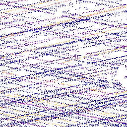
 var

 qualityMask

 =

 function
 (
 im
 )

 {

 return

 im
 .
 updateMask
 (
 im
 .
 select
 (
 'l2b_quality_flag'
 ).
 eq
 (
 1
 ))

 .
 updateMask
 (
 im
 .
 select
 (
 'degrade_flag'
 ).
 eq
 (
 0
 ));
 };
 var

 dataset

 =

 ee
 .
 ImageCollection
 (
 'LARSE/GEDI/GEDI02_B_002_MONTHLY'
 )

 .
 map
 (
 qualityMask
 )

 .
 select
 (
 'solar_elevation'
 );
 var

 gediVis

 =

 {

 min
 :

 1
 ,

 max
 :

 60
 ,

 palette
 :

 'red, green, blue'
 ,
 };
 Map
 .
 setCenter
 (
 12.60033
 ,

 51.01051
 ,

 12
 );
 Map
 .
 addLayer
 (
 dataset
 ,

 gediVis
 ,

 'Solar Elevation'
 );