
Page Summary
-
The dataset provides monthly global vegetation indices at 1km spatial resolution from 2002 to 2025.
-
Key bands include NDVI and EVI, along with detailed quality assurance information and surface reflectance bands.
-
Data has no restrictions on use, sale, or redistribution.
- Dataset Availability
- 2002-07-01T00:00:00Z–2026-05-01T00:00:00Z
- Dataset Producer
- NASA LP DAAC at the USGS EROS Center
- Cadence
- 1 Month
- Tags
Description
The Aqua Moderate Resolution Imaging Spectroradiometer (MODIS) Vegetation Indices (MYD13A3) Version 6.1 data are provided monthly at 1 kilometer (km) spatial resolution as a gridded Level 3 product in the sinusoidal projection. In generating this monthly product, the algorithm ingests all the MYD13A2 products that overlap the month and employs a weighted temporal average.
Documentation:
Bands
Bands
Pixel size: 1000 meters (all bands)
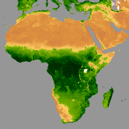
NDVI
Monthly NDVI average
EVI
Monthly EVI average
DetailedQA
VI Quality indicators
sur_refl_b01
Surface reflectance band 1 (red)
sur_refl_b02
Surface reflectance band 2 (near-infrared)
sur_refl_b03
Surface reflectance band 3 (blue)
sur_refl_b07
Surface reflectance band 7 (mid-infrared)
ViewZenith
View zenith angle of VI Pixel
SolarZenith
Sun zenith angle of VI pixel
RelativeAzimuth
Relative azimuth angle of VI pixel
SummaryQA
Quality reliability of VI pixel
SummaryQA Class Table
| Value | Color | Description |
|---|---|---|
|
0
|
None | Good Data: use with confidence |
|
1
|
None | Marginal Data: useful, but look at other QA information |
|
2
|
None | Snow/Ice: target covered with snow/ice |
|
3
|
None | Cloudy: target not visible, covered with cloud |
Terms of Use
Terms of Use
MODIS data and products acquired through the LP DAAC have no restrictions on subsequent use, sale, or redistribution.
Citations
-
Please visit LP DAAC 'Citing Our Data' page for information on citing LP DAAC datasets.
DOIs
Explore with Earth Engine
Code Editor (JavaScript)
 var

 dataset

 =

 ee
 .
 ImageCollection
 (
 'MODIS/061/MYD13A3'
 )

 .
 filter
 (
 ee
 .
 Filter
 .
 date
 (
 '2020-01-01'
 ,

 '2023-05-01'
 ));
 var

 ndvi

 =

 dataset
 .
 select
 (
 'NDVI'
 );
 var

 ndviVis

 =

 {

 min
 :

 0
 ,

 max
 :

 9000
 ,

 palette
 :

 [

 'ffffff'
 ,

 'ce7e45'
 ,

 'df923d'
 ,

 'f1b555'
 ,

 'fcd163'
 ,

 '99b718'
 ,

 '74a901'
 ,

 '66a000'
 ,

 '529400'
 ,

 '3e8601'
 ,

 '207401'
 ,

 '056201'
 ,

 '004c00'
 ,

 '023b01'
 ,

 '012e01'
 ,

 '011d01'
 ,

 '011301'

 ],
 };
 Map
 .
 setCenter
 (
 6.746
 ,

 46.529
 ,

 2
 );
 Map
 .
 addLayer
 (
 ndvi
 ,

 ndviVis
 ,

 'NDVI'
 );