
AI-generated Key Takeaways
-
This dataset of Sentinel-2 Level-1C data is deprecated and has been superseded by COPERNICUS/S2_HARMONIZED.
-
The dataset contains 13 UINT16 spectral bands representing TOA reflectance scaled by 10000, used for land monitoring studies.
-
Data is available from 2015-06-27 to 2025-10-17 with a revisit interval of 5 days.
-
Cloud masks (QA60 band) had changes in how they were produced over time.
-
The use of this data is governed by the Copernicus Sentinel Data Terms and Conditions.
- Dataset Availability
- 2015-06-27T00:00:00Z–2025-11-17T08:52:18.911000Z
- Dataset Provider
- European Union/ESA/Copernicus
- Revisit Interval
- 5 Days
- Tags
Description
See also collection COPERNICUS/S2_HARMONIZED that shifts data with PROCESSING_BASELINE '04.00' or above (after 2022-01-25) to be in the same range as in older scenes.
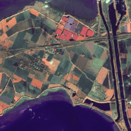
Sentinel-2 is a wide-swath, high-resolution, multi-spectral imaging mission supporting Copernicus Land Monitoring studies, including the monitoring of vegetation, soil and water cover, as well as observation of inland waterways and coastal areas.
The Sentinel-2 data contain 13 UINT16 spectral bands representing TOA reflectance scaled by 10000. See the Sentinel-2 User Handbook for details. QA60 is a bitmask band that contained rasterized cloud mask polygons until Feb 2022, when these polygons stopped being produced. Starting in February 2024, legacy-consistent QA60 bands are constructed from the MSK_CLASSI cloud classification bands. For more details, see the full explanation of how cloud masks are computed. .
Each Sentinel-2 product (zip archive) may contain multiple granules. Each granule becomes a separate Earth Engine asset. EE asset ids for Sentinel-2 assets have the following format: COPERNICUS/S2/20151128T002653_20151128T102149_T56MNN. Here the first numeric part represents the sensing date and time, the second numeric part represents the product generation date and time, and the final 6-character string is a unique granule identifier indicating its UTM grid reference (see MGRS ).
The Level-2 data produced by ESA can be found in the collection COPERNICUS/S2_SR .
For datasets to assist with cloud and/or cloud shadow detection, see COPERNICUS/S2_CLOUD_PROBABILITY and GOOGLE/CLOUD_SCORE_PLUS/V1/S2_HARMONIZED .
For more details on Sentinel-2 radiometric resolution, see this page .
Bands
Bands
B1
Aerosols
B2
Blue
B3
Green
B4
Red
B5
Red Edge 1
B6
Red Edge 2
B7
Red Edge 3
B8
NIR
B8A
Red Edge 4
B9
Water vapor
B10
Cirrus
B11
SWIR 1
B12
SWIR 2
QA10
Always empty
QA20
Always empty
QA60
Cloud mask. Masked out between February 2022 and February 2024.
MSK_CLASSI_OPAQUE
Opaque clouds classification band (0=no clouds, 1=clouds). Masked out before February 2024.
MSK_CLASSI_CIRRUS
Cirrus clouds classification band (0=no clouds, 1=clouds). Masked out before February 2024.
MSK_CLASSI_SNOW_ICE
Snow/ice classification band (0=no snow/ice, 1=snow/ice). Masked out before February 2024.
Image Properties
Image Properties
| Name | Type | Description |
|---|---|---|
|
CLOUDY_PIXEL_PERCENTAGE
|
DOUBLE | Granule-specific cloudy pixel percentage taken from the original metadata |
|
CLOUD_COVERAGE_ASSESSMENT
|
DOUBLE | Cloudy pixel percentage for the whole archive that contains this granule. Taken from the original metadata |
|
DATASTRIP_ID
|
STRING | Unique identifier of the datastrip Product Data Item (PDI) |
|
DATATAKE_IDENTIFIER
|
STRING | Uniquely identifies a given Datatake. The ID contains the Sentinel-2 satellite, start date and time, absolute orbit number, and processing baseline. |
|
DATATAKE_TYPE
|
STRING | MSI operation mode |
|
DEGRADED_MSI_DATA_PERCENTAGE
|
DOUBLE | Percentage of degraded MSI and ancillary data |
|
FORMAT_CORRECTNESS
|
STRING | Synthesis of the On-Line Quality Control (OLQC) checks performed at granule (Product_Syntax) and datastrip (Product Syntax and DS_Consistency) levels |
|
GENERAL_QUALITY
|
STRING | Synthesis of the OLQC checks performed at the datastrip level (Relative_Orbit_Number) |
|
GENERATION_TIME
|
DOUBLE | Product generation time |
|
GEOMETRIC_QUALITY
|
STRING | Synthesis of the OLQC checks performed at the datastrip level (Attitude_Quality_Indicator) |
|
GRANULE_ID
|
STRING | Unique identifier of the granule PDI (PDI_ID) |
|
MEAN_INCIDENCE_AZIMUTH_ANGLE_B1
|
DOUBLE | Mean value containing viewing incidence azimuth angle average for band B1 and for all detectors |
|
MEAN_INCIDENCE_AZIMUTH_ANGLE_B2
|
DOUBLE | Mean value containing viewing incidence azimuth angle average for band B2 and for all detectors |
|
MEAN_INCIDENCE_AZIMUTH_ANGLE_B3
|
DOUBLE | Mean value containing viewing incidence azimuth angle average for band B3 and for all detectors |
|
MEAN_INCIDENCE_AZIMUTH_ANGLE_B4
|
DOUBLE | Mean value containing viewing incidence azimuth angle average for band B4 and for all detectors |
|
MEAN_INCIDENCE_AZIMUTH_ANGLE_B5
|
DOUBLE | Mean value containing viewing incidence azimuth angle average for band B5 and for all detectors |
|
MEAN_INCIDENCE_AZIMUTH_ANGLE_B6
|
DOUBLE | Mean value containing viewing incidence azimuth angle average for band B6 and for all detectors |
|
MEAN_INCIDENCE_AZIMUTH_ANGLE_B7
|
DOUBLE | Mean value containing viewing incidence azimuth angle average for band B7 and for all detectors |
|
MEAN_INCIDENCE_AZIMUTH_ANGLE_B8
|
DOUBLE | Mean value containing viewing incidence azimuth angle average for band B8 and for all detectors |
|
MEAN_INCIDENCE_AZIMUTH_ANGLE_B8A
|
DOUBLE | Mean value containing viewing incidence azimuth angle average for band B8a and for all detectors |
|
MEAN_INCIDENCE_AZIMUTH_ANGLE_B9
|
DOUBLE | Mean value containing viewing incidence azimuth angle average for band B9 and for all detectors |
|
MEAN_INCIDENCE_AZIMUTH_ANGLE_B10
|
DOUBLE | Mean value containing viewing incidence azimuth angle average for band B10 and for all detectors |
|
MEAN_INCIDENCE_AZIMUTH_ANGLE_B11
|
DOUBLE | Mean value containing viewing incidence azimuth angle average for band B11 and for all detectors |
|
MEAN_INCIDENCE_AZIMUTH_ANGLE_B12
|
DOUBLE | Mean value containing viewing incidence azimuth angle average for band B12 and for all detectors |
|
MEAN_INCIDENCE_ZENITH_ANGLE_B1
|
DOUBLE | Mean value containing viewing incidence zenith angle average for band B1 and for all detectors |
|
MEAN_INCIDENCE_ZENITH_ANGLE_B2
|
DOUBLE | Mean value containing viewing incidence zenith angle average for band B2 and for all detectors |
|
MEAN_INCIDENCE_ZENITH_ANGLE_B3
|
DOUBLE | Mean value containing viewing incidence zenith angle average for band B3 and for all detectors |
|
MEAN_INCIDENCE_ZENITH_ANGLE_B4
|
DOUBLE | Mean value containing viewing incidence zenith angle average for band B4 and for all detectors |
|
MEAN_INCIDENCE_ZENITH_ANGLE_B5
|
DOUBLE | Mean value containing viewing incidence zenith angle average for band B5 and for all detectors |
|
MEAN_INCIDENCE_ZENITH_ANGLE_B6
|
DOUBLE | Mean value containing viewing incidence zenith angle average for band B6 and for all detectors |
|
MEAN_INCIDENCE_ZENITH_ANGLE_B7
|
DOUBLE | Mean value containing viewing incidence zenith angle average for band B7 and for all detectors |
|
MEAN_INCIDENCE_ZENITH_ANGLE_B8
|
DOUBLE | Mean value containing viewing incidence zenith angle average for band B8 and for all detectors |
|
MEAN_INCIDENCE_ZENITH_ANGLE_B8A
|
DOUBLE | Mean value containing viewing incidence zenith angle average for band B8a and for all detectors |
|
MEAN_INCIDENCE_ZENITH_ANGLE_B9
|
DOUBLE | Mean value containing viewing incidence zenith angle average for band B9 and for all detectors |
|
MEAN_INCIDENCE_ZENITH_ANGLE_B10
|
DOUBLE | Mean value containing viewing incidence zenith angle average for band B10 and for all detectors |
|
MEAN_INCIDENCE_ZENITH_ANGLE_B11
|
DOUBLE | Mean value containing viewing incidence zenith angle average for band B11 and for all detectors |
|
MEAN_INCIDENCE_ZENITH_ANGLE_B12
|
DOUBLE | Mean value containing viewing incidence zenith angle average for band B12 and for all detectors |
|
MEAN_SOLAR_AZIMUTH_ANGLE
|
DOUBLE | Mean value containing sun azimuth angle average for all bands and detectors |
|
MEAN_SOLAR_ZENITH_ANGLE
|
DOUBLE | Mean value containing sun zenith angle average for all bands and detectors |
|
MGRS_TILE
|
STRING | US-Military Grid Reference System (MGRS) tile |
|
PROCESSING_BASELINE
|
STRING | Configuration baseline used at the time of the product generation in terms of processor software version and major Ground Image Processing Parameters (GIPP) version |
|
PRODUCT_ID
|
STRING | The full id of the original Sentinel-2 product |
|
RADIOMETRIC_QUALITY
|
STRING | Based on the OLQC reports contained in the Datastrips/QI_DATA with RADIOMETRIC_QUALITY checklist name |
|
REFLECTANCE_CONVERSION_CORRECTION
|
DOUBLE | Earth-Sun distance correction factor |
|
SENSING_ORBIT_DIRECTION
|
STRING | Imaging orbit direction |
|
SENSING_ORBIT_NUMBER
|
DOUBLE | Imaging orbit number |
|
SENSOR_QUALITY
|
STRING | Synthesis of the OLQC checks performed at granule (Missing_Lines, Corrupted_ISP, and Sensing_Time) and datastrip (Degraded_SAD and Datation_Model) levels |
|
SOLAR_IRRADIANCE_B1
|
DOUBLE | Mean solar exoatmospheric irradiance for band B1 |
|
SOLAR_IRRADIANCE_B2
|
DOUBLE | Mean solar exoatmospheric irradiance for band B2 |
|
SOLAR_IRRADIANCE_B3
|
DOUBLE | Mean solar exoatmospheric irradiance for band B3 |
|
SOLAR_IRRADIANCE_B4
|
DOUBLE | Mean solar exoatmospheric irradiance for band B4 |
|
SOLAR_IRRADIANCE_B5
|
DOUBLE | Mean solar exoatmospheric irradiance for band B5 |
|
SOLAR_IRRADIANCE_B6
|
DOUBLE | Mean solar exoatmospheric irradiance for band B6 |
|
SOLAR_IRRADIANCE_B7
|
DOUBLE | Mean solar exoatmospheric irradiance for band B7 |
|
SOLAR_IRRADIANCE_B8
|
DOUBLE | Mean solar exoatmospheric irradiance for band B8 |
|
SOLAR_IRRADIANCE_B8A
|
DOUBLE | Mean solar exoatmospheric irradiance for band B8a |
|
SOLAR_IRRADIANCE_B9
|
DOUBLE | Mean solar exoatmospheric irradiance for band B9 |
|
SOLAR_IRRADIANCE_B10
|
DOUBLE | Mean solar exoatmospheric irradiance for band B10 |
|
SOLAR_IRRADIANCE_B11
|
DOUBLE | Mean solar exoatmospheric irradiance for band B11 |
|
SOLAR_IRRADIANCE_B12
|
DOUBLE | Mean solar exoatmospheric irradiance for band B12 |
|
SPACECRAFT_NAME
|
STRING | Sentinel-2 spacecraft name: Sentinel-2A, Sentinel-2B |
Terms of Use
Terms of Use
The use of Sentinel data is governed by the Copernicus Sentinel Data Terms and Conditions.
Explore with Earth Engine
Code Editor (JavaScript)
 /**
 * Function to mask clouds using the Sentinel-2 QA band
 * @param {ee.Image} image Sentinel-2 image
 * @return {ee.Image} cloud masked Sentinel-2 image
 */
 function

 maskS2clouds
 (
 image
 )

 {

 var

 qa

 =

 image
 .
 select
 (
 'QA60'
 );

 // Bits 10 and 11 are clouds and cirrus, respectively.

 var

 cloudBitMask

 =

 1
 <<
 10
 ;

 var

 cirrusBitMask

 =

 1
 <<
 11
 ;

 // Both flags should be set to zero, indicating clear conditions.

 var

 mask

 =

 qa
 .
 bitwiseAnd
 (
 cloudBitMask
 ).
 eq
 (
 0
 )

 .
 and
 (
 qa
 .
 bitwiseAnd
 (
 cirrusBitMask
 ).
 eq
 (
 0
 ));

 return

 image
 .
 updateMask
 (
 mask
 ).
 divide
 (
 10000
 );
 }
 // Map the function over one month of data and take the median.
 // Load Sentinel-2 TOA reflectance data.
 var

 dataset

 =

 ee
 .
 ImageCollection
 (
 'COPERNICUS/S2'
 )

 .
 filterDate
 (
 '2018-01-01'
 ,

 '2018-01-31'
 )

 // Pre-filter to get less cloudy granules.

 .
 filter
 (
 ee
 .
 Filter
 .
 lt
 (
 'CLOUDY_PIXEL_PERCENTAGE'
 ,

 20
 ))

 .
 map
 (
 maskS2clouds
 );
 var

 rgbVis

 =

 {

 min
 :

 0.0
 ,

 max
 :

 0.3
 ,

 bands
 :

 [
 'B4'
 ,

 'B3'
 ,

 'B2'
 ],
 };
 Map
 .
 setCenter
 (
 -
 9.1695
 ,

 38.6917
 ,

 12
 );
 Map
 .
 addLayer
 (
 dataset
 .
 median
 (),

 rgbVis
 ,

 'RGB'
 );