

Page Summary
-
The Maps SDK for Android Utility Library is an open-source library offering advanced features for enhancing Google Maps in Android applications.
-
It provides utilities for importing GeoJSON and KML data, adding heatmaps, clustering markers, managing multiple map layers, and working with polylines.
-
The library includes features for customizing markers with bubble icons and performing spherical geometry calculations for distances, areas, and headings.
-
Developers can quickly set up the library by following the provided setup guide and access detailed documentation for each utility.
-
A demo app is included in the GitHub repository showcasing the usage of the various classes and functionalities within the library.
Looking for advanced features to add to your maps? The Maps SDK for Android Utility Library is an open-source library of classes that are useful for a range of applications. The GitHub repository includes the utility classes and a demoapp that illustrates the use of each class.
In this video, Chris Broadfoot discusses the utility library, with a focus on polyline decoding, spherical geometry, and bubble icons.
Quick setup
To install the Maps SDK for Android Utility Library, follow the setup guide .
The utilities
Import GeoJSON onto your map
You can store features in GeoJSON
format and use this utility to render them as a layer on top of a map.
Call addLayer()
to add your GeoJSON data to the map.
You can also add individual features by calling addFeature()
,
passing in a GeoJsonFeature
object.
For details, see the documentation on the Google Maps Android GeoJSON Utility .
Import KML onto your map
Using this utility, you can convert KML
objects into geographical shapes and render them as a layer on
top of a map. Call addLayerToMap()
to add your layer to the
map. You can access properties in a KML object by calling getProperties()
on any Placemark, GroundOverlay, Document or
Folder.
For details, see the documentation on the Google Maps Android KML Utility .
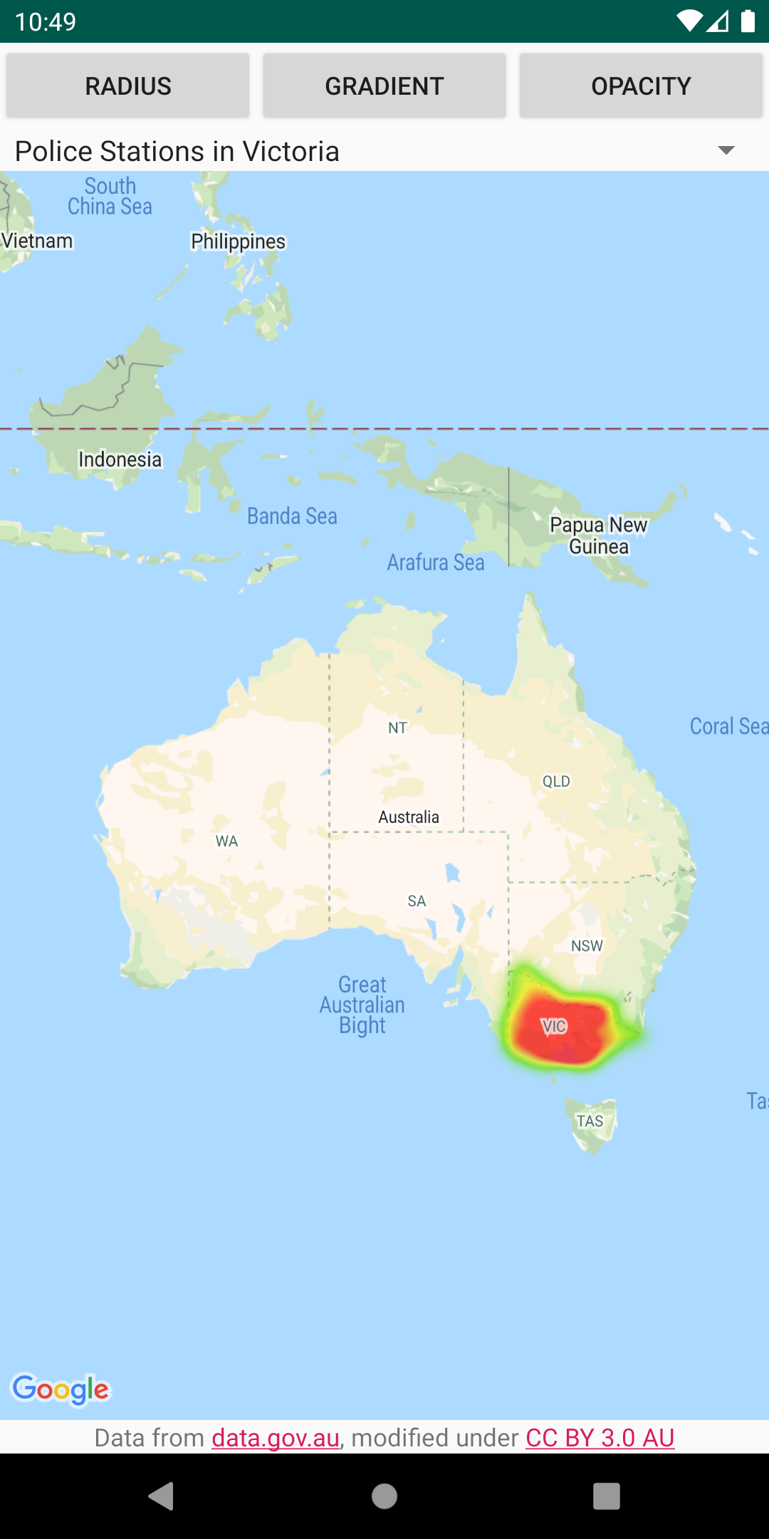
Add heatmaps to your map
Heatmaps make it easy for viewers to understand the distribution and
relative intensity of data points on a map. Rather than placing a marker at
each location, heatmaps use color and shape to represent the distribution
of the data. Create a HeatmapTileProvider
, passing it a
collection of LatLng
objects representing points of interest
on the map. Then create a new TileOverlay
,
passing it the heatmap tile provider, and add the tile overlay to the
map.
For details, see the documentation on the Google Maps Android Heatmap Utility .
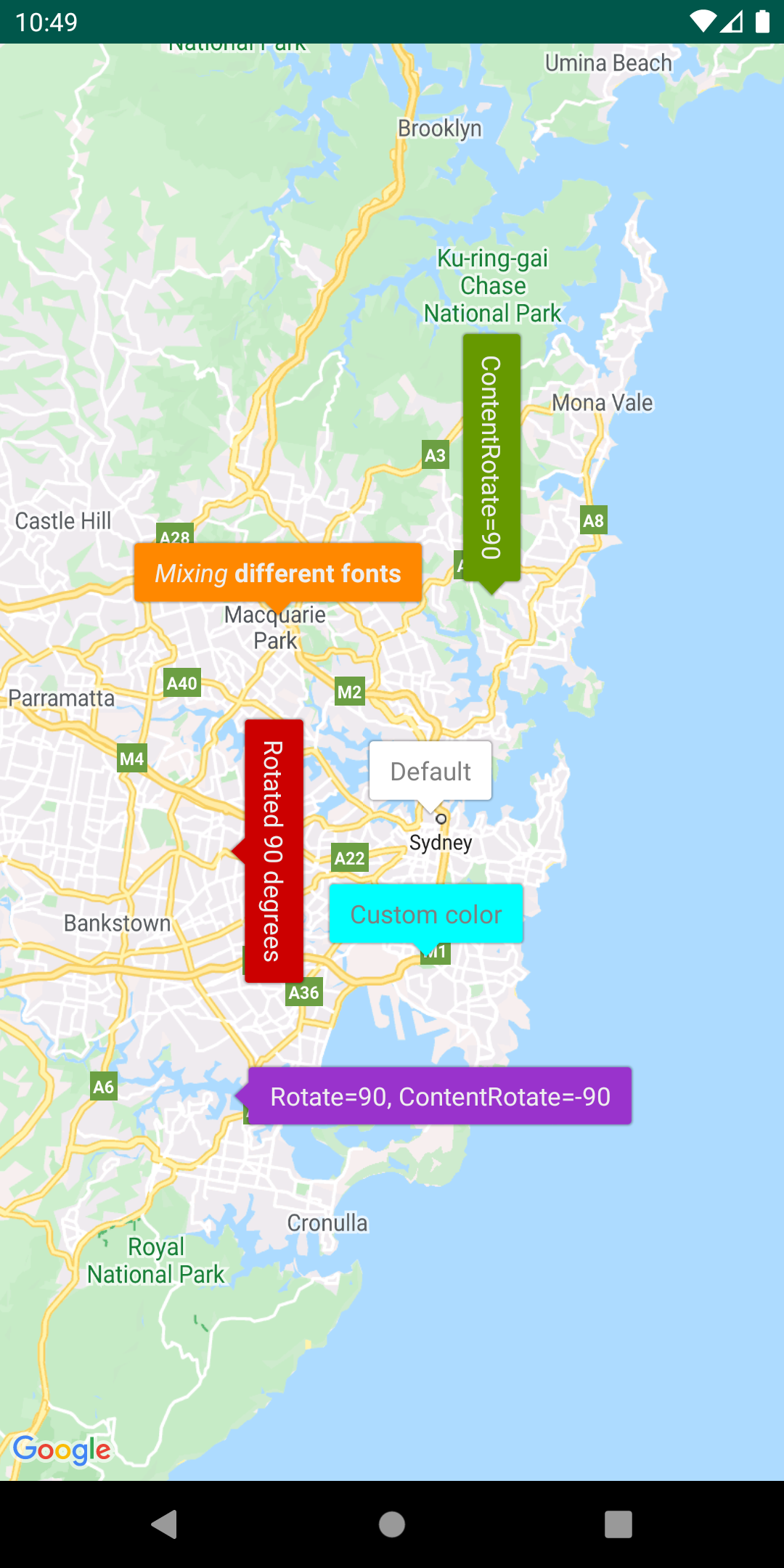
Customize markers via bubble icons
Add a IconGenerator
to display snippets of information
on your markers. This utility provides a way of making your marker icons
look a bit like info windows, in that the marker itself can contain text
and other content. The advantage is that you can keep more than one marker
open at the same time, whereas only one info window can be open at once.
You can also style the markers, change the orientation of the marker
and/or content, and change the marker's background image/nine-patch.
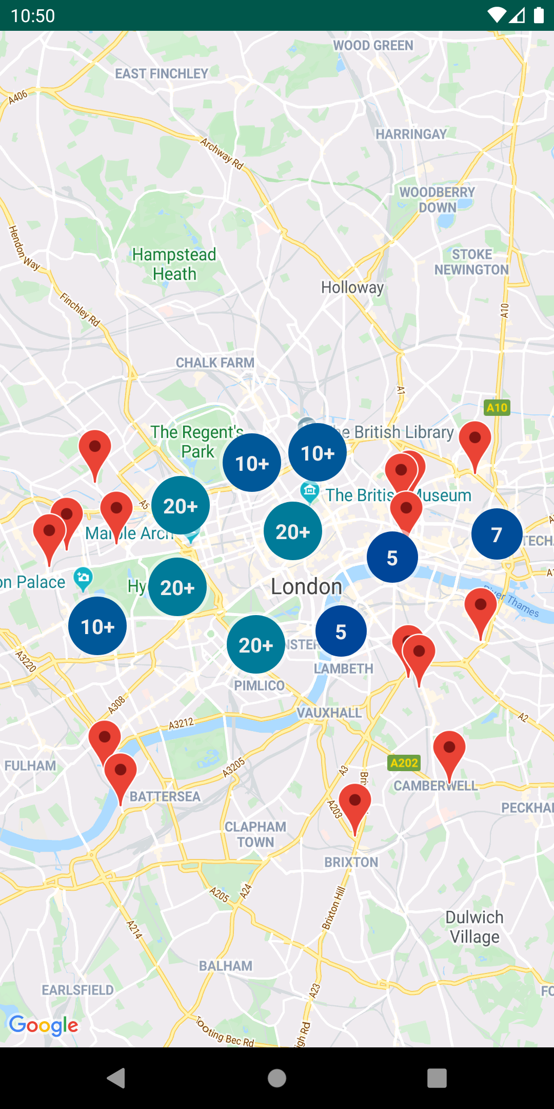
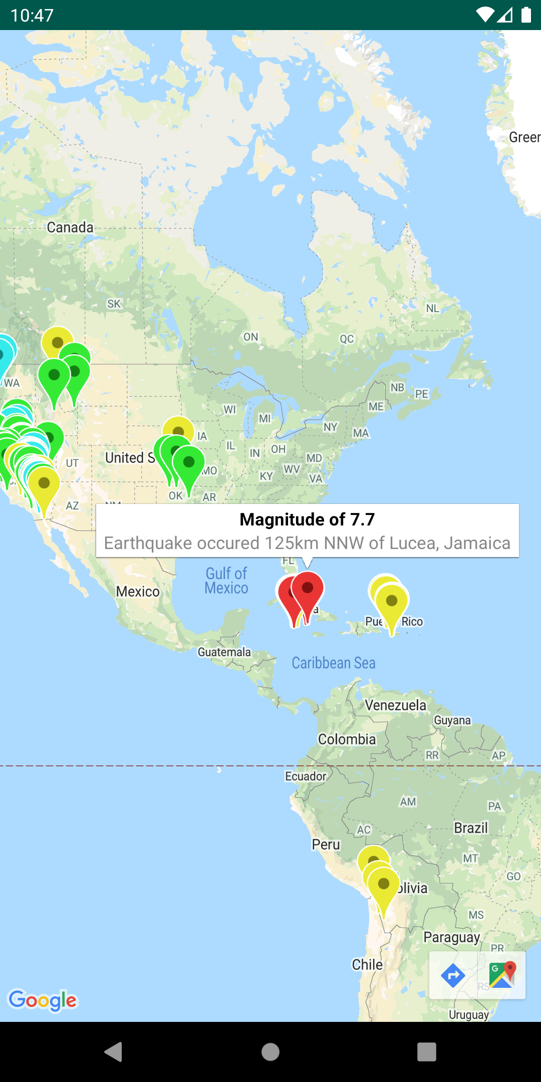
Manage marker clusters
The ClusterManager
helps you manage multiple markers at
different zoom levels. This means you can put a large number of markers on
a map without making the map hard to read. When a user views the map at a
high zoom level, the individual markers show on the map. When the user
zooms out to a lower zoom level, the markers gather together into
clusters, to make viewing the map easier.
For details, see the documentation on the Google Maps Android Marker Clustering Utility .
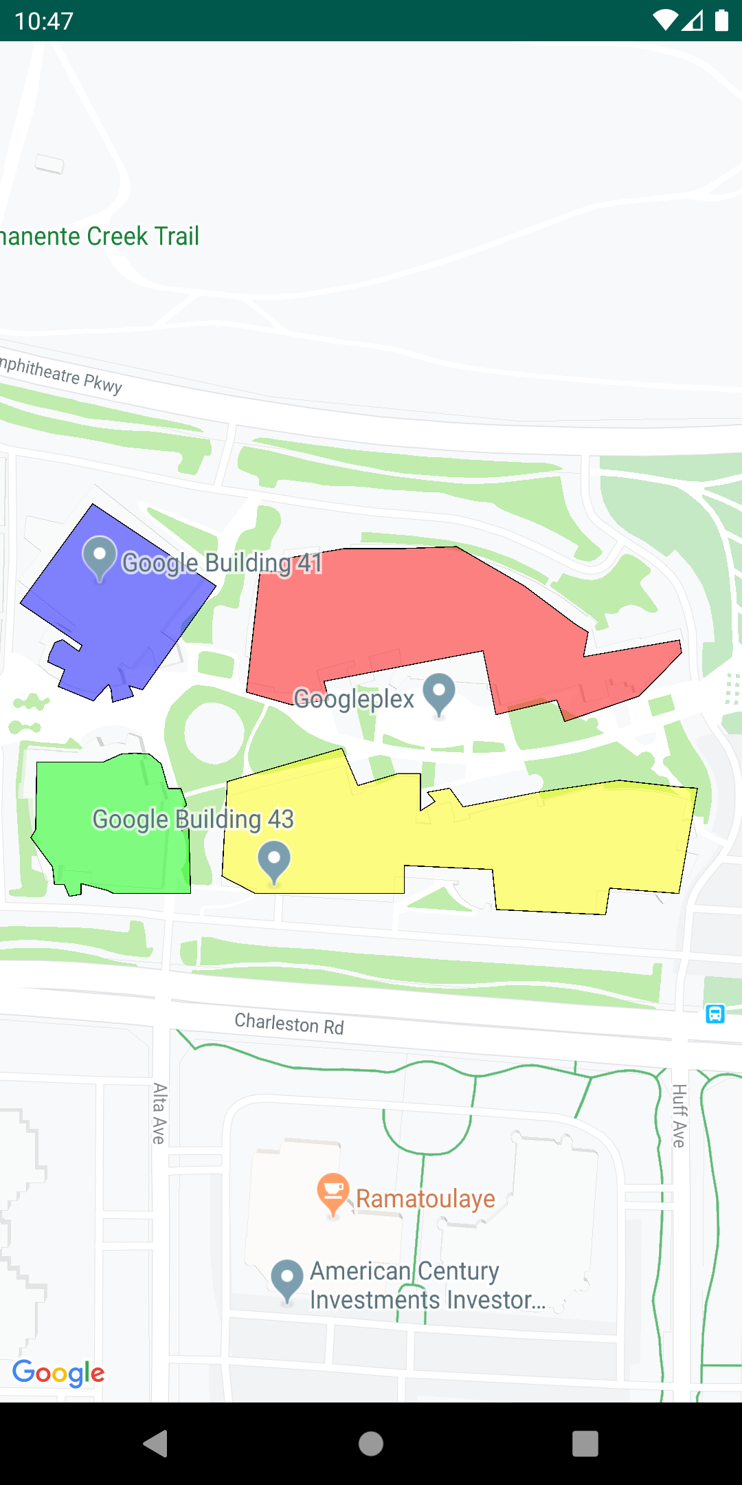
Add multiple layers to the same map
You can show features from GeoJSON, KML, and clusters — as well as your
own markers, polylines, and polygons — all on the same map. These layers
can also be made interactive by adding a click listener to each layer.
Simply instantiate the MarkerManager
, GroundOverlayManager
, PolygonManager
, and PolylineManager
classes and pass
them into the constructors of GeoJsonLayer
, KmlLayer
, ClusterManager
when you set them up. You can then use the above Manager
classes directly to add your own markers, polylines,
and polygons to the map.
For details, see the documentation on the Google Maps Android Multi Layer Demo.
Encode and decode polylines
The PolyUtil
is useful for converting encoded polylines and
polygons to latitude/longitude coordinates, and vice versa.
In Google Maps, the latitude and longitude coordinates that define a polyline or polygon are stored as an encoded string. See the detailed explanation of polyline encoding . You may receive this encoded string in a response from a Google API, such as the Directions API (Legacy).
You can use PolyUtil
in the Maps SDK for Android Utility
Library to encode a sequence of latitude/longitude coordinates ('LatLngs')
into an encoded path string, and to decode an encoded path string into a
sequence of LatLngs. This will ensure interoperability with the Google
Maps APIs web services.
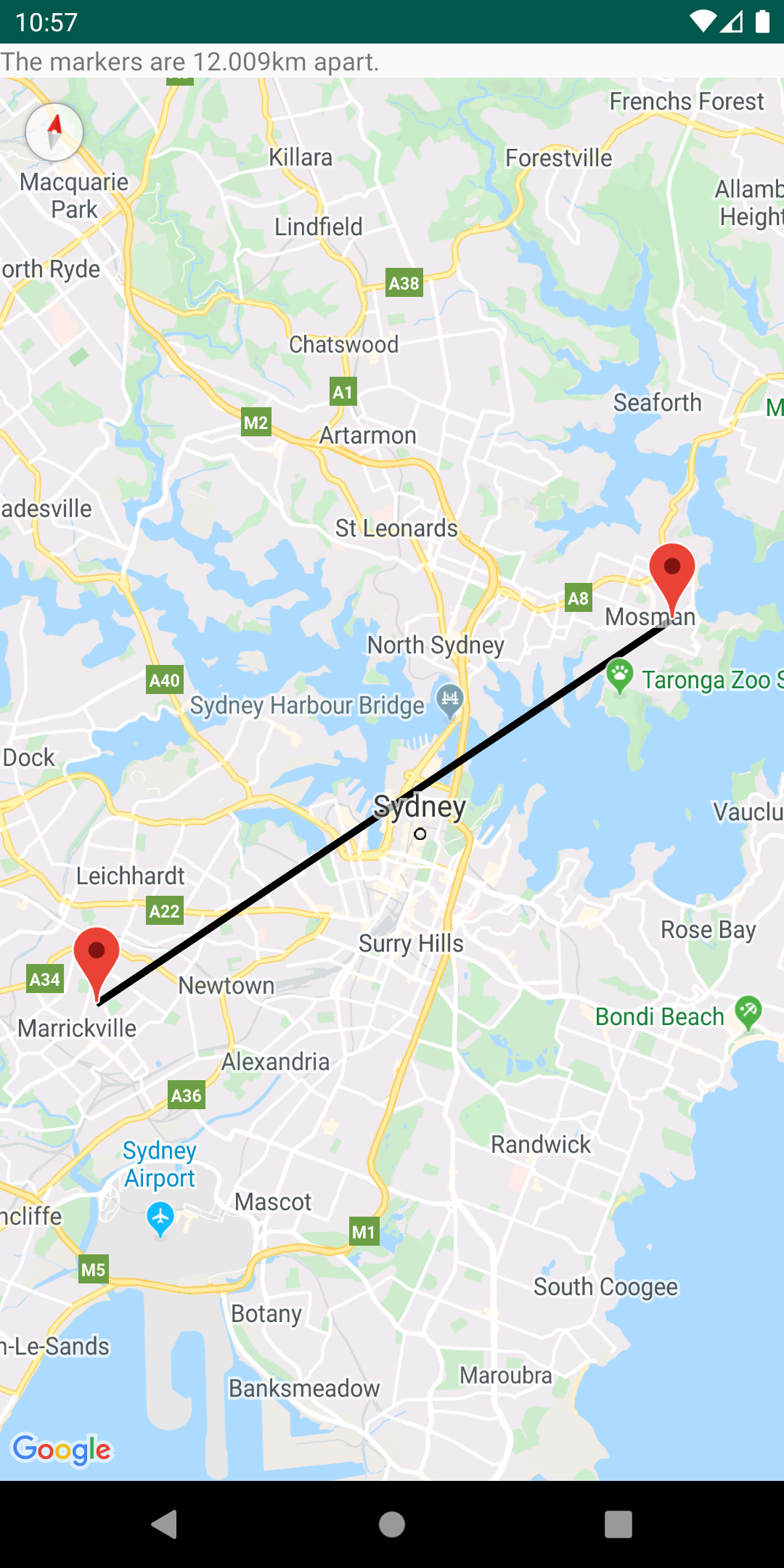
Calculate distances, areas and headings via spherical geometry
Using the spherical geometry utilities in SphericalUtil
, you
can compute distances, areas, and headings based on latitudes and
longitudes. Here are some of the methods available in the utility:
-
computeDistanceBetween()– Returns the distance, in meters, between two latitude/longitude coordinates. -
computeHeading()– Returns the bearing, in degrees, between two latitude/longitude coordinates. -
computeArea()– Returns the area, in square meters, of a closed path on the Earth. -
interpolate()– Returns the latitude/longitude coordinates of a point that lies a given fraction of the distance between two given points. You can use this to animate a marker between two points, for example.
Refer to the reference documentation for a full list of methods in the utility.
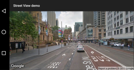
Check if a location is supported in Street View.
The StreetViewUtil
class provides functionality to check whether a location is
supported in Street View. You can avoid errors when adding a
Street View panorama to an Android app by calling this metadata utility
and only adding a Street View panorama if the response is OK
.
For details, see the documentation on the Street View metadata utility on GitHub.