Littleton Downtown Riverwalk
Enjoying Mt. Washington
Franklin's Lesson For Today
NH Helicopter Rides
FREE Stuff To Do
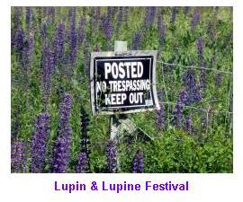
NH Lupine Photos
Avoiding Romance Scams
Pittsburg NH Profile
Mascoma Lake Profile
Farm To Table Restaurants
Carroll NH (Twin Mtn.) Profile
Colebrook NH Profile
Ben Kilham Profile
Whitefield NH Profile
Clark's Trading Post
NH Mapping Project Completed
LiDAR Maps Land Surface Elevations Across Half of New Hampshire.
Accurate, high-resolution data on land surface elevations and contours (topography) are critical for mapping the extent of areas impacted by river flooding as well as numerous other economic development and natural resource applications. Before LiDAR, topographic maps produced decades ago by the USGS were the most commonly used source of elevation data for engineers and other resource professionals. However, at best, the elevation contour lines on these maps have a vertical accuracy of +/- 5 feet for much of the state and +/- 20 feet in more mountainous areas, too inaccurate to support modern computerized mapping methods. LiDAR technology has been proven to provide a vertical accuracy of +/- 6 inches, and has become the widely accepted standard for acquiring elevation data over large geographic areas.
The mapping is performed using a rapidly pulsing laser that is directed toward the ground from an airplane flying 180 miles per hour in a straight line at an altitude of over a mile. As the laser sweeps back and forth along the flight path, a highly sensitive detector measures exactly how long it takes for each beam of light to travel to the ground and reflect back to the plane. One half of the round-trip travel time is then converted into a distance based on the speed of light, resulting in millions of closely spaced ground elevation data points. Data are collected along parallel, overlapping flight lines to achieve complete coverage, much like mowing the lawn.
Because LiDAR can "see" the ground even when it is covered by trees, the method is ideal for mapping in heavily forested areas like much of New Hampshire. Details as subtle as old stone walls and cellar holes are readily recorded. The collection of the data was just completed. Once the data has been reviewed for quality assurance, the final elevation data for the entire project area will be publically available by late summer or early fall 2016.
Posted 11/25/15
Seussical (9/6-15)
2001 Space Odyssey (9/7)
Muster in the Mountains (9/7-9)
Wingzilla (9/8)
Canzoniere Grecanico Salentino (9/9)
Things [Mom] Taught Me (9/13-23)
Reach the Beach (9/14-15)
WM Storytelling Festival (9/14-16)
Metallak Race (9/15)
Mandeville & Richards (9/15)
Cohase Film Slam (9/16)
Tricycle Grand Prix (9/16)
Rodney Crowell (9/21)
NH Highland Games (9/21-23)
Don Who (9/22)
Harvest Celebration (9/22)
Health & Wellness Fair (9/22)
Jeep Invasion (9/22)
Lakes Region Tri Festival (9/22-23)
Pat Metheny (9/26)
Driving Miss Daisy (9/27 - 10/6)
Neko Case (9/27)
Shot of JD (9/28)
Dixville Half Marathon (9/29)
New Hampshire Marathon (9/29)
Matthew Odell (9/30)
Lincoln Fall Craft Festival (10/6&7)
Sparrow Blue & Crowes Pasture (10/6)
Oktoberfest (10/6-7)
White Mountain Oktoberfest (10/6-7)
Fall Foliage Celebration (10/6-8)
Sandwich Fair (10/6-8)
Paddle the Border (10/7)
Lincoln Fall Craft Festival (10/7-9)
Shadow Play (10/10)
Killer Joe (10/11-21)
Greg Brown (10/12)
Camping & RV Show (10/12-14)
Riverfire & Horrorfest (10/13)
Jay Stollman Band (10/19)
Murder Dinner Train (10/19-20)
Pumpkin Patch Express (10/19-21)
All Things Pumpkin (10/20)
Ethan Setiawan Band (10/20)
Bettye LaVette (10/26)
Murder Dinner Train (10/26-27)
Pumpkin Patch Express (10/26-28)
Berlin Jazz (10/27)
Photo Galleries


Business Directory
Moffett House Museum
Northland Restaurant
Perras Treasures Party Store
Personal Touch Home Health
White Mountain Cottages
more ►


Clark's Trading Post
Cog Railway
Conway Scenic Railroad
Flume
Fort Jefferson Fun Park
Jericho Mountain ATV Park
Kancamagus Highway
Littleton Riverwalk
Lost River Gorge
Mountain Meadow Funplex
Mt. Washington Auto Road
Polar Caves
Santa's Village
Storyland
Vertical Ventures
Whale's Tail Water Park
Woodstock Inn & Brewery
more ►
Community Profiles
Bethlehem
Bretton Woods
Colebrook
Conway
Franconia
Gorham
Hanover
Jackson
Lebanon
Lincoln
Littleton
North Conway
Pittsburg
Plymouth
Twin Mountain
Whitefield
Wolfeboro
more ►
Recreation and Tourism
Farm To Table Restaurants
Hiking To Crash Sites
Little Ski Areas
Local Movie Theaters
Local Performance Theaters
Moose Tours
more ►
Other Resources
NH Cabins & Cottages
NH Census Info
NH Data (OEP)
NH Fishing Reports
NH Foliage Report
NH Hiking Trail Conditions
NH Lottery
NH Movie Guide
NH Road Conditions
NH Ski Reports
NH Snowmobile Trail Reports
NH State Parks
NH Town Officials Directory
NH Weather
Summer Safety Tips
[.pdf]
White Mtn. National Forest
VisitNH.Gov
Copyright 2012-2018 by George C. Jobel , 603-491-4340. All Rights Reserved.


